..............................................--- Fanny Keys (Marathon) ---
...............................................................--- April 9 to 11, 2011 ---
Nights Anchorage: 024o 42.695' N -- 081o 06.598' W -- Fanny Keys (Marathon)Trip Odometer: 293.5 miles
Days Mileage...: 0.0 miles
........
Above was one of the sunrises at Fanny Keys. As the Keys drop off the south end of Florida they arc more and more in a westerly direction, so the sun seems to come up and go down in a little different place than you would think it would.
........
As I mentioned on the previous page our anchorage was very close to the ...
........
... channel boats use going in and out of the marina and other businesses. This didn't prove to be a problem for us or them since we were able to anchor over to the side with our shoal draft Mac.
........
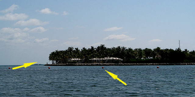
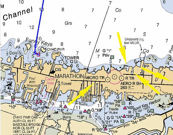
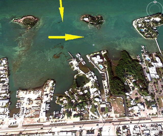
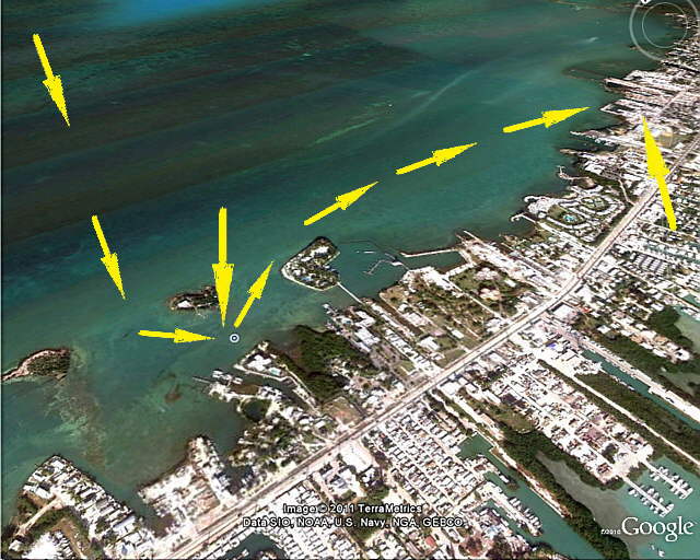
One of the biggest problems on a trip like this especially the first time you are in a new area is finding fuel and a place that you can go ashore and leave the dinghy and expect to find it when you return. We found that they had diesel and gas (what we needed) up at Keys Fisheries Market and Marina and they said that we could leave the dinghy and go ashore. They were a little over a mile from the anchorage, so we got in the dinghy and took off. We headed off in the direction of the arrow above....
........
....over the cable area (right arrow) and off around the far key (left arrow).
........
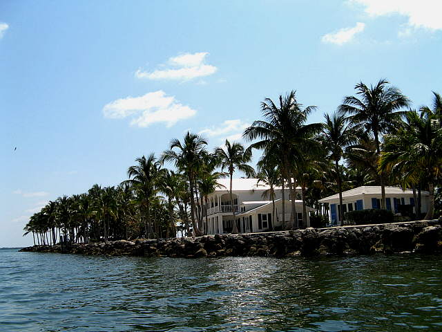
There is a huge place on the one key that is all private, but that I believe you can rent out. I think I found a link that said something like $17,000 a week.
........
... We never saw anyone there and I think our WiFi connection on our long distance WiFi setup was using their connection but wasn't positive about that.
........
The arrow above off the dinghy's stern points back to the Mac and her anchorage.
........
We continued past the key and on past this...
........
.... somber couple finally...
........
... approaching Keys Fisheries from the direction of the double arrows above. Looking at the picture above the bottom right arrow points to the entrance into the fuel dock, middle arrow, that is mainly used by commercial fishing boats. We had a couple fuel containers in the dinghy to fill. The first time there we left the dinghy underneath a sea wall, bottom left arrow. We then walked down to West Marine from there. I didn't like leaving the dinghy there as it was too secluded. The buildings above the middle bottom arrow are connected with the commercial end of Keys Fisheries.
After coming back we got the dinghy and went around to the restaurant/marina, top left arrow. You enter where the middle right single arrow is. I would pull up to the rocks there and let Ruth out and she walked the sea wall around to the restaurant as it wasn't easy getting in and out of the low dinghy there.
........
Above is a view coming from the direction where the Mac was. The right arrow points to the restaurant and the left points to the direction to proceed in to go to the fuel docks. To go to the restaurant you would turn in to starboard where the left arrow is above.
........
Again the left arrow points to where you need to go to the fuel dock and the right is the entrance into the restaurant. We didn't want to take the Mac to the fuel dock as we don't feel comfortable yet in tight quarters like that. The commercial boats that use the fuel dock and tie up back in there at night though are way bigger than us, so it is possible to take a large boat back in there. I think I saw where they have 5 1/2 feet at the marina at low tide if that is of any help.
........
Here is the entrance into the restaurant. I'd let Ruth out on the rocks, middle arrow an she would walk around, right arrow. I proceeded over and tied the dinghy where the left arrow is pointing.
........
Here is Ruth preparing to make her entrance and ...
........
... likewise myself.
........
We got a good look at what a crab pot looks like. This is a great place to eat. Good food and very reasonable prices. After the trying to die from food poisoning episode at Everglades City I was a little reluctant to eat seafood, but did and enjoyed it. We put ashore here more than once. In fact while on the Gulf side this was the only place that we could find to put ashore.
........
Here you can see why it is a little difficult getting out of the dinghy where we tied up. Part of the marina is in the back ground.
........
We had JSI in Saint Petersburg make up a ......
........
.... 25 foot cable, top arrows, that we use to secure things somewhat. We take one end (thimbles on both ends) and lock it to the outboard and then pass it through the bag, bottom left arrow, that is padlocked at the top. From there it goes up and around something on shore and then back to the boat and back to the lock on the outboard. In the future most of what is in the bag will be in.....
........
....the storage unit above that we made for the Zodiac that fits under the seat and that becomes the new seat surface with the old seat going through it. Also.....
........
........
... the Zodiac will be better protected from the sun and abrasion on nearby objects. That mod is all ( HERE ).
........
While we were eating the U.S. Customs and Border Protection guys motored in and had lunch. They tied up by our dinghy and for a minute I thought that they were going to crunch it, but all went well. This wouldn't be the last we saw of them as the same boat/guys paid us a visit later in the trip, but we will leave that story for later.
........
Notice the 900 HP hanging off the stern of the boat. We saw is once at speed, probably nowhere near top speed, but still impressive. I'm glad that I'm not buying the gas.......well I guess I am some of it anyway.
........
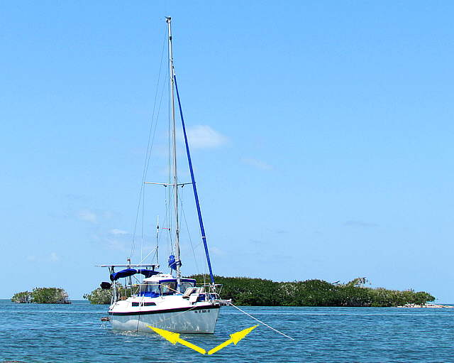
Above the two arrows point to the two rodes going to the 22 lb. claw and the 25 lb. Manson Supreme. Anchoring like this kept the boat in pretty much the same place all of the time. I was really surprised at the currents here. I didn't really understand where they were coming from and going to but I swam up to the anchor off to the tight in the picture above once and I couldn't really swim very well against the current and had to pull myself up to the anchor using the rode. I was very careful in the water every where as I'd read about people and people in dinghy's getting carried out and away from their boats. Be very careful of this wherever you might find your self. Sometimes I had a long line trailed out from behind the boat as a little insurance in case I got swept past the boat.
........
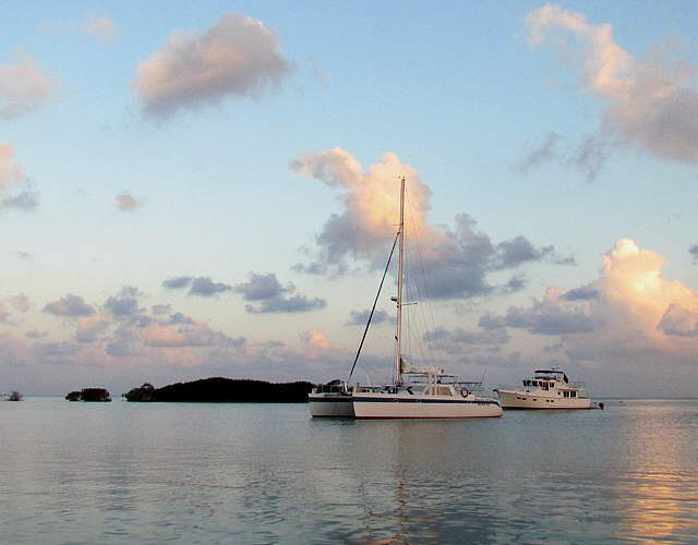
One night this cat came up very close behind us and anchored. I let them know that I had two anchors down and wasn't going to swing much. They then backed down a ......
........
... a little further from us, but this guy anchored just off the back of the cat. I would of not liked that, but .....
........
.... they didn't have any problems and both left in the morning.
........
This was a pretty anchorage and we would like to go back, but be wary of weather coming in from the Gulf side and the water isn't deep.


