............--- Little Shark River to Fanny Keys (Marathon) ---
.................................................................--- April 8, 2011 ---
Nights Anchorage: 024o 42.695' N -- 081o 06.598' W -- Fanny Keys (Marathon)Trip Odometer: 293.5 miles
Days Mileage...: 48.6 miles
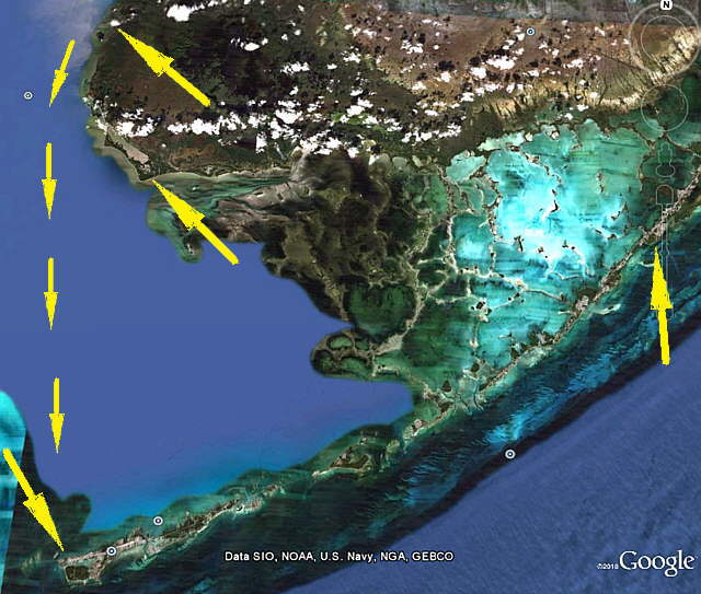
We were awake and eating breakfast before the sun came up. I had thought that for once we might be the first boat off anchorage but that wasn't to be. Others also figured that an early start was in order. The reason being that most of the boats that spent the night here and that were going north were probably going to go at least as far as Marco Island and a number were probably trying for Naples or Ft. Myers or even further north. Those going south, like us, were probably headed for one of three places, Marathon (out destination), Key West or the Dry Tortugas. All of those are also close to 50 miles or more from Little Shark.
........
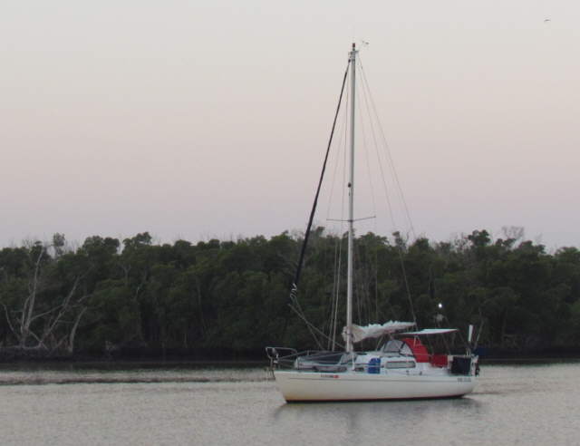
I went up on deck and start to get the boat ready to go. I normally started the outboard, put the cockpit cushions back in place, start getting the rigging ready in case we had to put the sails up, but I was soon back down in the cabin. The mosquitoes were ferocious and I had shorts and a tee shirt on. I slid into long pants and a long sleeve shirt and put on one of the bug-net hats we had bought but never worn and even put on some light gloves. I told Ruth she had better dress the same.
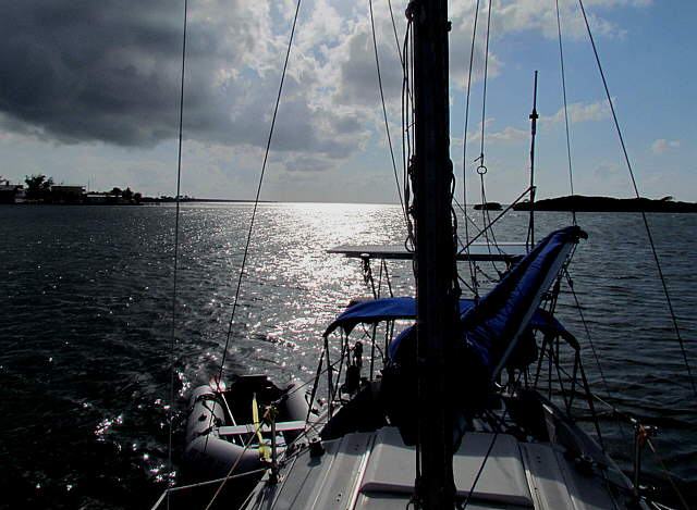
She soon appeared in the cockpit and I took down the pop-top cover and folded it and lowered the pop-top down. We had this down to maybe a 2 minute job by now. I went forward and she manned, womaned, the tiller and the outboard and soon we had both anchors up and on the bow and were headed towards the gulf.
........
We still did manage to get out before most of the other boats, but ...
........
...as we left Little Shark behind us with the sun coming up there where probably 5-6 other boats already heading either north or south. Also as we left more boats departed Little Shark behind us and there again some turned north and others followed us south. Well actually they didn't follow us for too awfully long as they were a lot longer and faster than us.
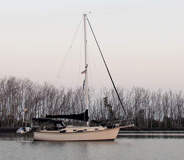
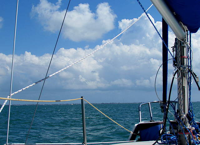
As the day progressed we would go from a west southwest (short time) to a south west heading (little longer time) then a south and finally a south southwest course for the majority of the days passage. We were able to motor sail for a good part of the day on the Genoa at about 5 knots with the outboard running at part throttle.
We were by far the smallest boat within sight (not sure where the Seaward 25 went). As we watched the larger boats head off in the direction of Key West and the Dry Tortugas we began to wish that we could spend some time down in these waters and others in a larger boat where we would be a little more comfortable on longer trips yet and also not have to watch the weather quite a close as we do on the Mac. Also we were up and down on every wave that ran under us and they all seemed to be pretty much on rails. Most had their sails or at least one sail up and I'm sure that some were also running their diesels, but the sight of them slowly pulling away from us made us want to be in the same type of situation someday. We had done a lot of Internet searches for a boat that would fit our budget and also for one that might fit our needs and decided to continue that search.
We motorsailed ahead on our course to Marathon and after a couple hours everyone else had moved out of sight over the horizon. One thing that did start to appear over the horizon more and more where crab pots. Hundreds of them. We had been through them before, but maybe never in the numbers that we were now seeing. Row after row of them. We didn't have any real problems with them, just steer this way or that a little to avoid them. We had heard from others about them in Florida Bay so they came as no real surprise.
Here are 2 videos taken while we still had the Genoa up.
(click HERE for video #1)
(click HERE for video #2)
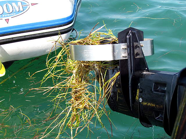
Except for the crab pots things were going smoothly for us in the videos above and being out of sight of land for the first time proved to be a little anticlimactic also. Then the sh.....t hit the fan or more appropriately the sea grass hit the prop. We had never read about this problem, but I guess that it became the #1 problem we had on the trip.
We started seeing floating sea grass that seemed to be floating in a SW direction about 90 degrees to our course. At first it wasn't much and fairly thin and we just motor-sailed through it. Also about this time the wind was coming in on the nose and the Genoa just wasn't doing much so we furled her in.
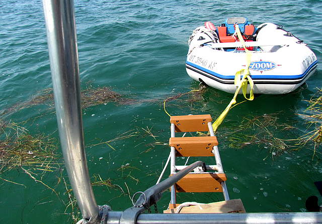
Then the sea grass started appearing in long mats and if we motored through them they fouled the prop. Some times I could reverse the prop and get it off, but more often we would stop...
........
... and I'd step out on the ladder/tow bar, thank goodness that it was there, and ...
........
...reach over and untangle the grass off of the prop. I'm not sure if the prop-guard that we had installed was making matters worst or better, but it was on and we had to deal with the situation.
We cut back on the speed to about 3 knots and I started steering the boat standing up so that I could look ahead better. The long mats of grass were usually a couple hundred feet apart and maybe 100 fee long. As I said they were moving slowly along on a course that was about 90 degrees to ours. I'd see a long mat of grass and then turn 90 degrees to port and run parallel to it until the end of it and then turn 90 degrees to starboard and run between it and the one that was astern of it. So now we were spending a good portion of our time going 90 degrees away from our destination.
I worried a little about fuel, but felt we had plenty since we had filled the 19 gallon tank at little Marco Island and that should of been good for 190 miles and we had been sailing some since then. I did start to worry about daylight as it didn't seem like we were now making a lot of headway in the right direction. We had SeaClear running on the computer and had the waypoints also in the handheld Garmin 76 so I didn't worry about getting to Marathon, but did worry about getting there in the dark as we had never been there and information on anchoring on the Gulf side was sketchy.
It seemed like it went on like this forever, but it was more like an hour and then it started to thin to the point that the majority of the time we were back on a continuous course towards Marathon. If the wind is right and you are doing good sailing through the grass would be a lot better deal. We might of tried this, but the wind direction would of meant a number of tacks and we just wanted to get to Marathon at this point.
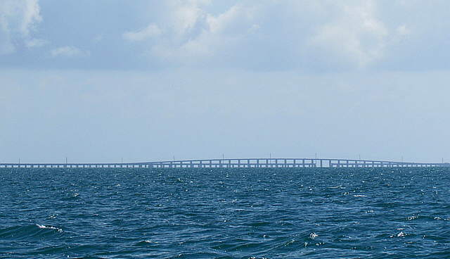
Not too long after the main grass patch, it never totally went away, we started to see the islands northeast of Big Pine Key and then way off in the distance we could see...
........
.... Seven Mile bridge in the distance (telephoto shot above). It was one of the longest bridges in existence when built in 1909-1912. Well the original lower bridge above was. It was a railroad bridge then and later converted to an auto bridge and finally replaced by the newer higher bridge that was constructed in 1978 to 1982. The old bridge still stands except for the visible opening above that use to be a swing bridge in that section.
........
Also the Gulf shore of Knight's Key in the distance where Marathon is finally came into view.
Here is a video approaching Fanny Keys (just off Knigth's Key) at Marathon (click HERE for video).
........
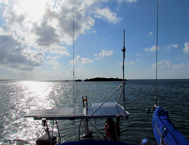
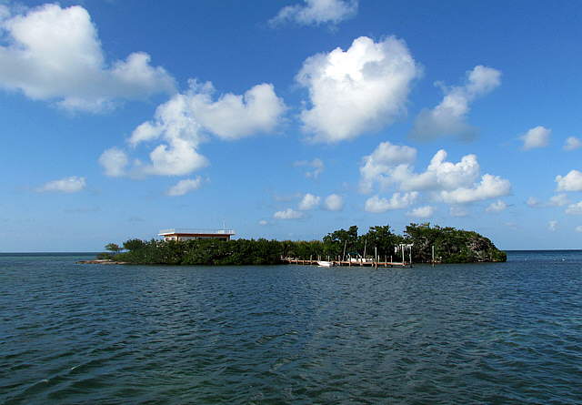
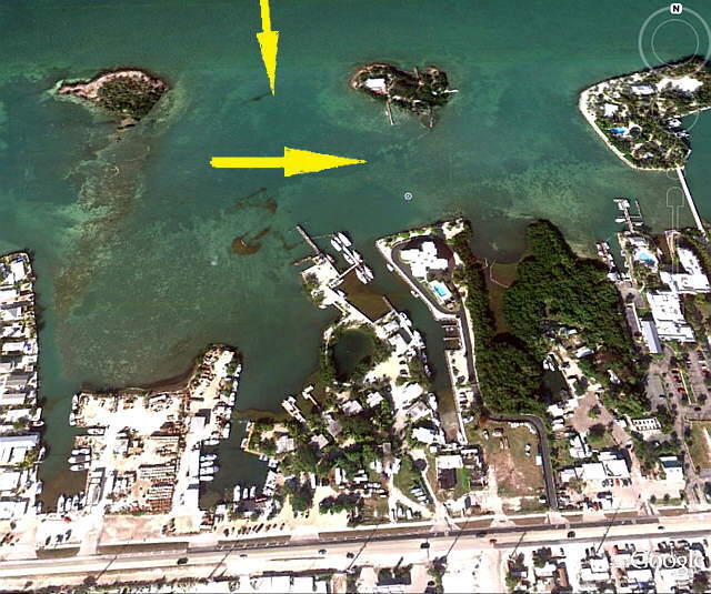
Anchorage's on the Gulf side at Marathon are not very protected. After some consideration and reviewing the cruising guides we decided on trying to get in behind Fanny Keys. They are 3 very small keys with the lowest one shown above. Just to the northeast of it is....
........
..... this small key and we worked into 5 feet or so of water behind it.
........
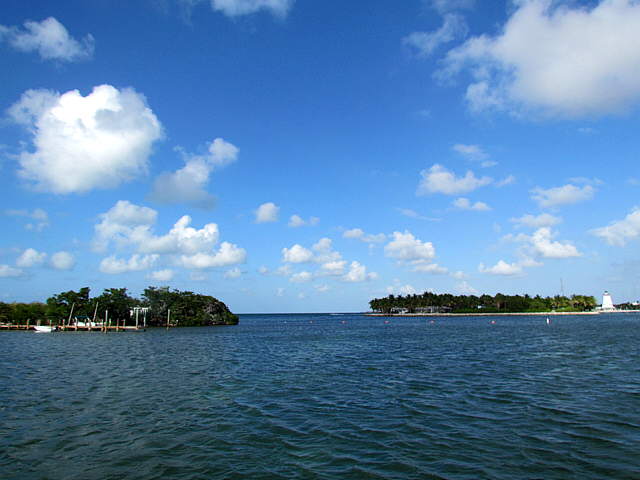
It is the left key above and a little further away was yet another key that is connected to Marathon via a causeway. In the foreground are some floats in the water that mark an underwater cable going to the key on the left. The water was too shallow to anchor over that far so we put two anchors down off the key to the left above.
........
The reason for the two anchors in a Bahamian moor was to try and keep the Mac from swinging all around into shallow water and to stay free of the channel into and out of the Marina shown above that was not very far away.
........
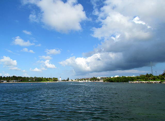
Another view of the markers for the underwater cable. You could go over it with a dinghy.
........
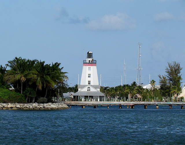
A telephoto shot of the causeway out to the other key and the lighthouse in the distance.
........
We really liked this anchorage as it was pretty there and the water was crystal clear. A fellow on one of the boats at the marine did say that it could get quite rough if there was a storm bringing waves in from the Gulf. That didn't happen while we were there as all of the wind came from the east.
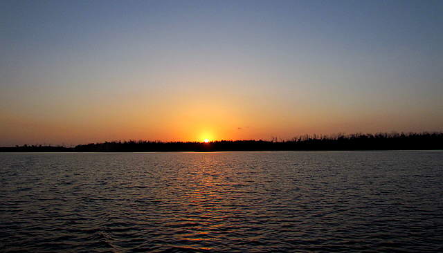
Video crossing Florida Bay from Little Shark River to Marathon ... (click HERE for video #1)
Second video crossing Florida Bay ... (click HERE for video #2)