........---Twin Island & Upper Priest Lake ---
......................................--- July 14-15, 2009 ---
14 JUL 09 -- Night's Anchorage -- By West Twin Island
( N. --o --.---' -- W. --o --.---' )
The next morning dawned with clear skies and the sun out. Our little cove on the south side of Reddy Bay was good to us and in a few days would prove to be a real life saver.
........
We were headed north on the lake, but decided to check out Grandview Resort as we would return there when our part came in. We sailed a mile or so north of Grandview and sailed around for a little over an hour recharging the batteries with our on-board generator.
........
After the batteries were charged we headed over to Gandview for ice and gas and some food as the next day we would be on our way north to Upper Priest Lake where there was no services. We had only docked once before and it took us two tries to dock this time. We weren't doing to well on the first approach and decided to go around and make another pass. The second pass went very smoothly. After tying up we went up to their small store and found out that they had ice and a very little food and no gas. They do have a bar/restaurant which we didn't take advantage of. This was the first time we had bought ice since we left home.
We found out that Elkins resort about a mile away had gas, so we motored over there and got a couple gallons of gas, which we really didn't need, but at this point we weren't too sure how much we would be using.
........
After we left Elkins we put the sails back up and sailed north about 4 miles with a moderate 5 mph south wind behind us to the north side of a point just across from one of the Twin Islands. There is an island on each side of the lake in this area and the two together are called Twin Island.
........
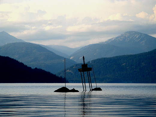
Right in front of our anchorage were a number of rocks that were marked by a channel marker, but between them and the shore....
........
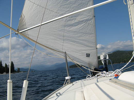
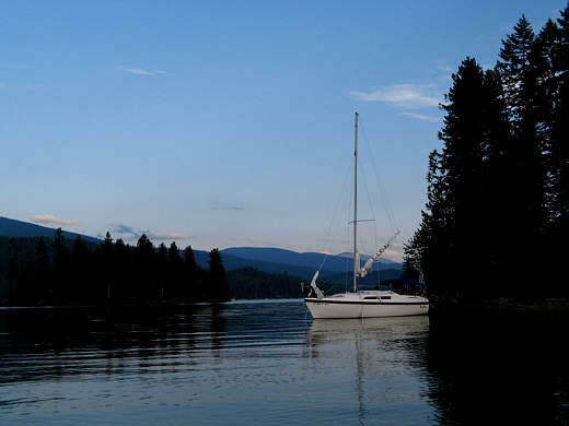
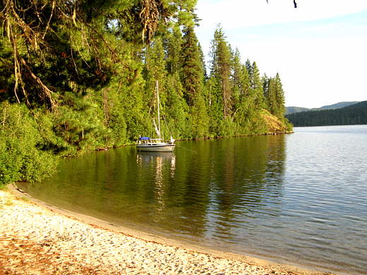
............ there was plenty of depth for the Mac. Here you can see the one Twin Island to the left. A first for us was that we anchored using just the sails, but had the outboard running just in case.
........
We were unprotected to the north, but the winds were suppose to remain from the south, which they did. Here you can see the rear line running to shore. Later we decided that using this light line to store was not a good idea and started to use one of our anchor lines for the shore line. This was a good anchorage for us and .................
........
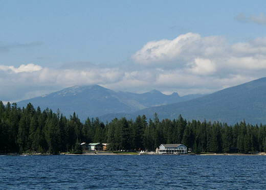
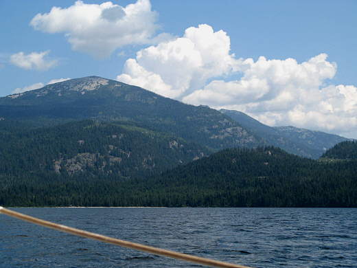
...........we would return to it, but our immediate goal for the next few days was Upper Priest Lake that is nestled under the mountains in the distance in the above picture.
15 JUL 09 -- Night's Anchorage -- East side of Upper Priest Lake( N. --o --.---' -- W. --o --.---' )
12.1 miles sailing and 2.5 miles with outboard on river..........
-----------------------------------------------------------------------------
This would prove to be a very big day for us in a couple different ways!!
........
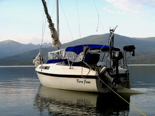
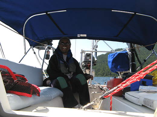
We left our anchorage with the sails, but again with the outboard running just in case. We had spent the previous night just to the right of the west Twin Island (small island in the center of the above picture). We ran north a little over 5 miles.....
........
......with Ruth at the tiller and with a trailing south 5-10 mph wind at our backs to the north end..............
........
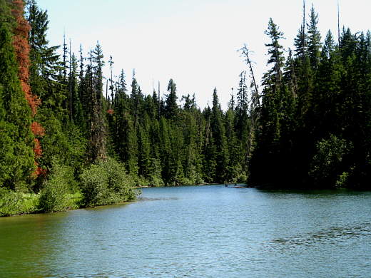
......of Priest Lake where we would find the Thoroughfare. The Thoroughfare is the 2 1/2 mile river that connects Upper Priest and Priest and flows from Upper Priest to Priest. The river inlet comes in from the west-northwest with a long breakwater protecting it and some very high dollar homes behind it.
The wind was at this point a high, for us, 10-12 mph and fairly large waves were building. I did an overly confident move and tried to run us into the narrow river channel behind the breakwater with the intention of dropping the sails in the calmer water there before starting up the outboard. As we entered the narrow channel things happened fast and before we knew it we were in very shallow water and the centerboard hit on our 26S Mac with a swing centerboard. I took over the tiller and started the outboard. Ruth went below and tried to pull the centerboard up, but she couldn't get it to raise. We changed positions and I went below. Now the rudder also had kicked up and it was hard to steer and we were almost into a dock right in front of a house with of course people on shore taking all of this in. She was able to get us turned in time and headed back out into open water as I continued to pull the centerboard up with no luck. All of this was happening very fast and I couldn't understand how the centerboard could be stuck down unless it was somehow wedged in its well. I started to think I was going to have to go over the side in cold water to hopefully fix things.
Then I finally looked up under the sink at the cable/rope combination that is used to pull the centerboard up and saw that the cable part that was going down to the centerboard was actually slack. I saw the the knot where the rope into the cabin attaches to the cable had gone past the block where it makes a turn and was stuck on the other side of the block and wouldn't go back when we would pull on the line in the cabin. So the centerboard was fine and I just had to untie the line from the cable and move it to the other side of the block and everything was fine again.
With that fixed and with us back out in the lake with the wind and waves and the outboard running we took the sails down. Of course in hindsight we should of done this 30 minutes earlier. We re-entered the river channel with our audience waiting to see if there would be a repeat of our earlier appearance. This time under control, probably disappointing so to them, we started the 2 1/2 mile run up the .................
........
......river. The river is about 100-150 yards wide most of the way and fairly deep. We had the centerboard most of the way up and the rudder full down and didn't hit either on the run between the two lakes. I stood on the bow and gave hand signals to Ruth as to how to stay in the main channel and avoid the sunken trees that were in the river at places and the shallows on the inside of the river bends. I think it was on this journey that we developed me using hand signals instead of yelling back and forth. If I wanted her to turn I just held my arm down low where she could see it and pointed in that direction and held it there until we were on the new course that I wanted. Then with my hand/fingers straight down I would move my hand fore/aft a few times to signal that this was the new course. By pumping my hand up or down I could indicate that I wanted to go faster or slower. This works great, especially around other people as you silently move the boat where you want with out having to utter a sound. We have come together doing this where we handle the boat as one and use this method whenever I'm up front and even in the cockpit while anchoring, docking or just going down the lake.
The scenery along the river was great and we passed about 6 power boats and a number of kayakers coming down from their day trip to Upper Priest. The river is a no-wake zone for its total length so we motored along at a very slow pace, but enough to keep the rudder working.
Upon entering Upper Priest we went towards the west side and ran into shallow water and popped the clam cleat holding the down haul on the rudder and it came up. The water in these lakes and the river are very, very clear and you can see 15-20 feet down easily. The problem is you can't tell if you are looking at the bottom through 5 feet of water or 15 feet of water. After getting back into deeper water and re-setting the rudder we motored about 1/2 mile down the lake and then floated around and made some sandwiches for lunch.
After lunch and with the jib and main up and in 10-13 mph winds according to the wind gauge we sailed for about an hour in the best conditions we had ever sailed in at this early point in our sailing careers. Remember that at this point we were about 10 days from our first day on the water in a sailboat and this without any instructions on how to do this other than what we had read on the Internet.
........
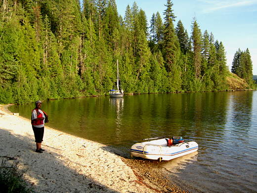
As the winds started to subside we sailed over to a very small cove, really no more than an indention on the east side of the lake, with a nice sandy beach. We lowered the sails and made one pass on the motor looking to see if we could anchor there. It was shallow for the first 15-20 feet as you can see in the picture above by looking behind the dingy. Then the bottom quickly fell off into deep water. This meant that to get the anchor in shallow enough water so that we didn't have to put out more anchor line than we had (230') we would have to throw the anchor in close to shore.
We ran parallel and just off the shore by the sand beach and then threw the anchor into the shallow area by it. Then with the boat drifting south parallel to the main shore and headed towards the shore that went out to the point I let out about 180' of rode until the boat was about to run into the shore running out to the point.
........I took a stern line ashore in the dingy and pulled the boat tight on it and tied off to a tree on shore. With so much rode out and the boat so close to the shore with the sandy beach the boat could easily swing into the shore if we didn't tie the stern to the shore. I was pretty proud of this arrangement, but it would prove to be a major mistake the next morning.
........
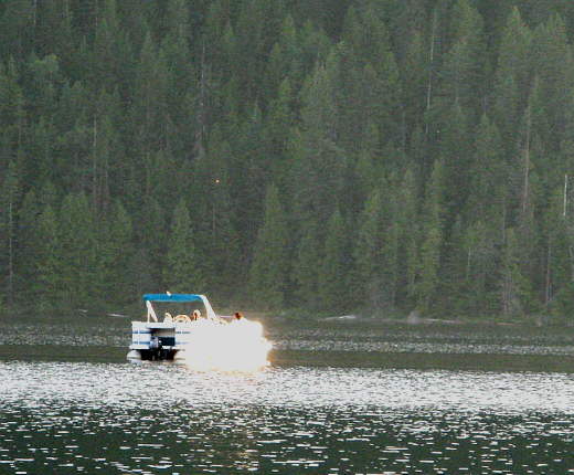
An hour or so before sunset a pontoon boat came out of the river channel and started floating around a few hundred yards from us and someone on it started playing the trumpet and not too bad at that. I took a guess that this guy would run people up from Priest to Upper Priest and then serenaded them for a while before taking them back down to Priest.
........
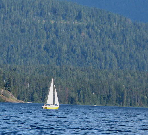
Shortly after the pontoon boat left a smaller sailboat than ours went by about 1/4 mile out in the lake headed north towards the end of the lake. There were three people on board and they spent the night on board or camped on the shore as we saw them for a little while the following day. I'm not good at identifying other sailboats yet, but it looked like it could of been a Venture (if someone can tell me please let me know).