..........--- Past the Marina and Quite a Bit More ---
...............................................--- Monday Sept. 28, 2009 ---
Day's Starting and Stopping Points Under Sail:
Today's Starting Waypoint #2 = N. 36o 58.595' -- W. -111o 28.621'
Today's Ending Waypoint #3 = N. 37o 00.336' -- W. -111o 23.769'
Night's Anchorage: North Shore of Main Channel in small bay.
Anchorage = N. 37o 00.455' -- W. -111o 23.755'
Today's Progress: Sailed Total = 9 1/4 miles -- Up-Lake = 6 1/2 miles -- Motored = 1/2 milesTrip Totals: Sailed 12 1/4 miles -- Up Lake Miles 8 -- River Mile 13 -- Motored 7 miles
Getting off anchor this day provided a moment of anxiety. As I pulled the Mac to the anchor with the anchor rode in water with visibility all the way to the bottom I noticed that we were going over our anchor and past it, not to it as I was expecting. Then I noticed a long crevice in the solid sandstone that made up the bottom here. I thought that we had swung around on anchor and that the chain had fallen in the crevice and was now probably lodged there. Well I got to the other end of the underwater crevice and sure enough the chain changed directions and headed back towards the anchor in the crevice as I had feared, but low and behold I was able to pull it right up from the crevice with no problem. We wouldn't get off this easy later in the trip, but that is another day.
Off anchor we motored out to the waypoint where we had quit sailing/floating the day before to about the same wind conditions which were slim to none. We slowly made our way .............
........
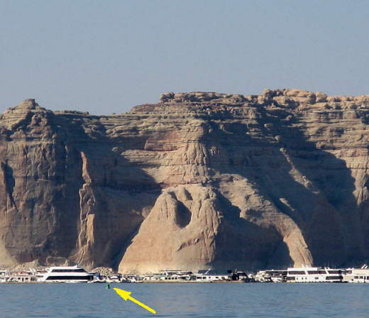
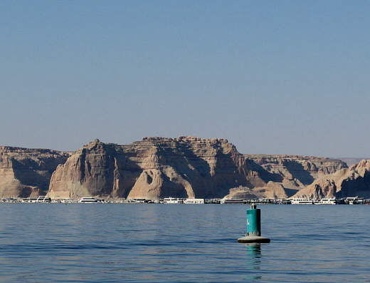
...... towards the green port side buoy (arrow) in winds that would come and go.
........
... it seemed we then were by this buoy forever. We would slowly tack (more beam reaches) to the east and back to the west again to find we had only gained a few feet on it, then finally we got a slight wind, well under a 5 mph average and started to make our way..............
........
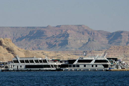
........ past the marina which probably has a couple hundred boats in it. Most of them are houseboats of different sizes with the biggest lying just inside the breakwater on the last row before the breakwater. I don't know if their location there was to protect the smaller ones or that it was prime real-estate to show them off.
........
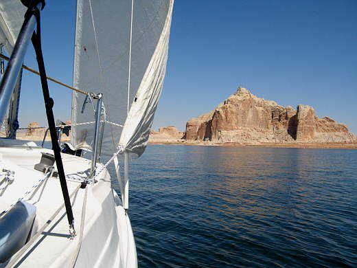
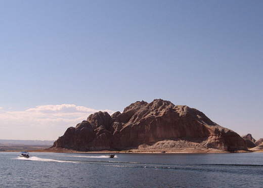
Past the marina with the genoa up we slowly made our way towards Castle Rock, which is the dominate land feature in this area. Just in front of it the bay swung to the east around the north side of Antelope Island. On our way there we were passed by....
........
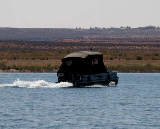
........ a number of boats under power including some rather strange looking ones. The one above gave me the impression of a jeep on water for some reason.
........
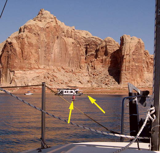
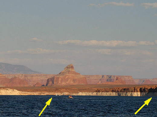
In front of Castle Rock are the narrows around the north end of Antelope Island that I worried about if the lake was low like it was. The channel, like most areas on the lake is marked by green buoys (right arrow) that should be on your port side going up-lake and red ones (left arrow) that should be on your starboard side if you want to stay in the deepest part of the channel. Often the lake was deep enough that it didn't matter if you were near them or not, but here where it was only 20 feet deep at its deepest point it was wise to at least be close to them.
The previous hour while we were making our slow approach to this area we hardly saw a boat make its way past this point, but as we neared it there seemed to be one house boat after another wanting to go through plus a number of smaller craft. Also about this time the wind died again....
........
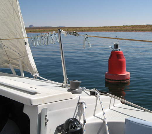
......... as you can see by the water. This left us just floating along again and we tried to stay out of everyone's way by getting as close to the buoys as possible without much help from the rudder. I'm sure they wondered, especially after spotting the Honda hanging on our transom, why didn't we just motor past this restricted stretch and get out of everyone's way. Well, we were on our mission, so we floated along hoping..........
........
...... no one would run over us. It was suppose to be a no wake zone, but some of the boats........
........
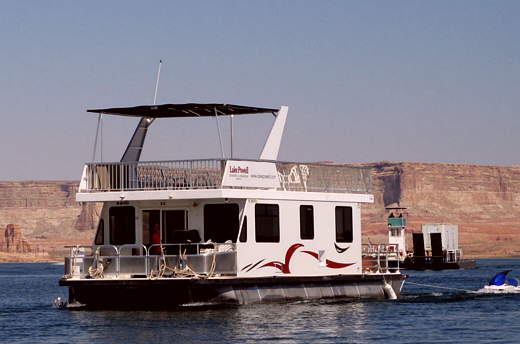
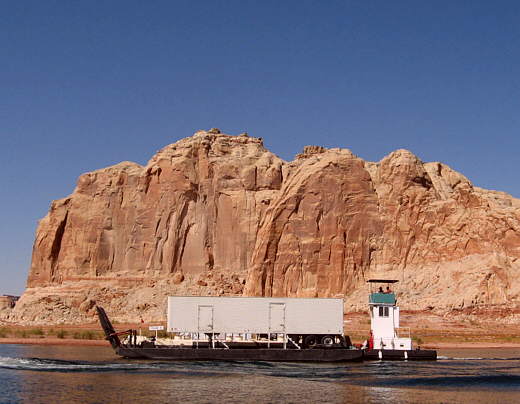
........ didn't seem to be interested in observing that, like the one in the previous picture that passed the supply barge that was coming from Dangling Rope Marina 40 some odd miles up-lake.
........
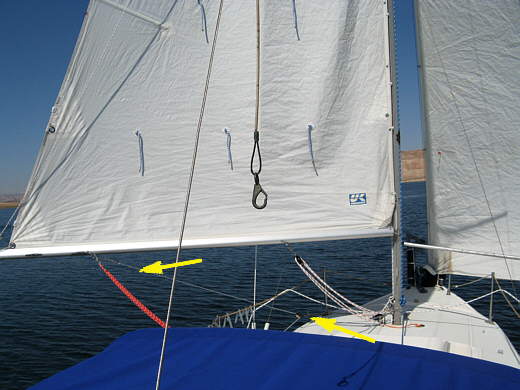
Past the narrows the wind picked up where it was just noticeable out of the west, so we started running to the east. In the past we had some not so good moments when we did an accidental jibe while running and the boom went swinging over to the other side with such force you thought it had surely just broke something. I'd read about rigging preventer lines to help this situation. We had a block and sheet that came with the boat and probably was to be used with the spinnaker that we had not gotten the courage to use yet. I ran a line from the block's bracket to the center cleat at the bow and tied it off there so that the block would stay ahead of the mast, but could swing side to side on it's control line. Then I put a carabiner clip on one end of a line we had and hooked it to..............
........
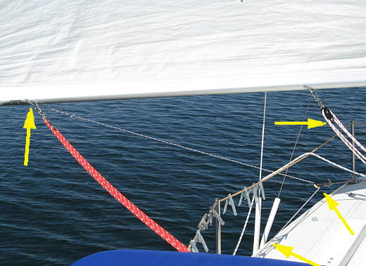
......... the boom (left arrow) where the boom sheet attaches and then took the line forward on that side outside the shrouds to the block (bottom right arrow) and from there back (bottom left arrow) inside the shrouds to a cleat on the side of the cockpit. This setup worked great except that to change sides and run the main on the other side of the boat I would have to bring the boom into the center of the cockpit and hold it there with the main sheet and then detach the preventer line and take it around the mast to the other side of the boat and reattach it to the boom and then let the boom/main out on that side. Still it was worth the effort and saved our butts more than once when we either didn't keep the boat on the right course or the wind changed direction slightly.
Later in the trip I found another cheap hardware store block I had and rigged up a second preventer line, so we had one on each side and didn't have to make the trip up and around the mast that a single preventer required. I'll have pictures of that later in this story and over the winter we will order some other blocks, fairleads and cam cleats to make the preventers work even better. One thing for sure is that we will use them from here on as they work so well, especially when the wind is really up and you are running.
........
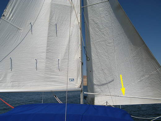
We moved east in the light wind wing on wing using the whisker pole (arrow) to help hold the genoa out. We don't have to much luck not using it if the winds are light.
........
With Castle Rock receding in the back ground and finally making way we eventually reached the point where..........
........
......... we turned southeast around the northeast side of Antelope and headed towards the main channel of the lake. We were also now getting into some nicer scenery than what was around the dam area of the lake.
........
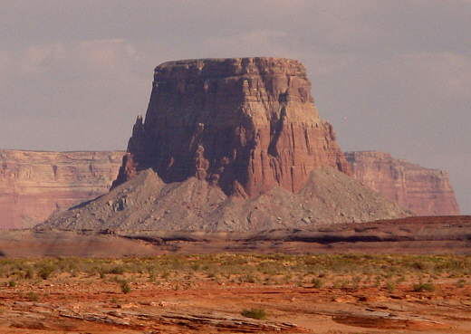
Navajo Mountain was off to the east beckoning us to come in that direction. Rainbow Bridge is at the base of it on the north side (left side in picture), but going there would have to wait until another trip as this was a trip were we would stay in the main channel of the lake except for some anchorages. We would head towards Navajo Mountain though and pass by the canyon that goes to Rainbow Bridge. Once past the mountain the lake turns in a more northerly direction up to its headwaters at Hite. Navajo Mountain is on the Navajo Nation and even though it isn't one of their four main sacred mountains it is still a sacred mountain to them. It is also mostly in Utah and is in the county (San Juan) where we live, which is one of the larger counties land wise in the U.S..
Of some interest is that the NOAA weather transmitter for this area is on Navajo Mountain, so if you can see the mountain you will probably get weather forecasts. When we were very close to the mountain for a couple days we didn't as we were in deep canyons there that blocked the reception. Also on a 3 day trip we had taken to Lake Powell the first of September up by Hite we couldn't receive the weather there either. Our antenna for the marine radio is on the stern of our boat and I'm moving it to the top of the mast to help this situation hopefully a little.
........
After turning south the west light wind changed to a much heavier wind out of the east and we soon found ourselves running 4+ knots and it seemed more like 40 after the last two days where our top speed was about 1 knot a couple times. We neared where the main channel came around Antelope Island on the south side from the west (right arrow) and to where we would follow it on east and then north (left arrow) where there were a couple house boats on the lake.
Upon reaching the main channel and leaving Antelope Island behind we began tacking up the main channel into the wind. We would soon be in a stretch where from the map there appeared to be no good places to anchor for the night, so we marked our position on the GPS (waypoint #3) and dropped the sails and motored a very short ways over to a very small and narrow rock lined cove. Most of the time when I mention "rock lined" in this journal I'm talking solid rock (sandstone) and not rocks on a dirt or sand shore.
Trying to maneuver the boat and turn it in this bay that was not much wider than the boat was long resulted in us running the bow into the shore twice. Luckily the hits were fairly slow and soft, if you can hit rock softly. One problem we were having was I had the idle set too high and we motored a little faster than we would of liked when in gear. Finally I dropped the anchor to just kind of hold the boat in place while I got a shore line to a rock just as the sun set.
For supper we grilled the last of the burgers on the grill and listened to the NOAA weather report and it wasn't a good one. Tuesday and Wednesday a big front was going to move through northern Utah and was suppose to bring snow to elevations of 6000 feet and more. The 90's we had been experiencing were suppose to be replaced with daytime highs in the 60's with night time lows maybe being in the high 40's, but more troubling than the temps were the wind speeds they were predicting not for northern Utah, but for where we were. Tuesday morning wind was suppose to be out of the southwest at 15-25 increasing to 20-30 in the afternoon. Tuesday night the winds were suppose to switch to the northwest and stay in the 20-30 mph range. More troubling was they had wind advisories with predicted winds as high as 50-60 at times.
We had a 4-5 mile stretch of narrow canyon before the lake again widened out. We decide to try and leave as early as possible if the winds weren't already high and sail up-lake. If the winds started getting too high before we made the next large bay we would motor into it and possibly up the west side of it looking for a small sheltered east/west running cove on the west side where we could wait out the storm before continuing up-lake. With a plan in mind it was off to bed.
........
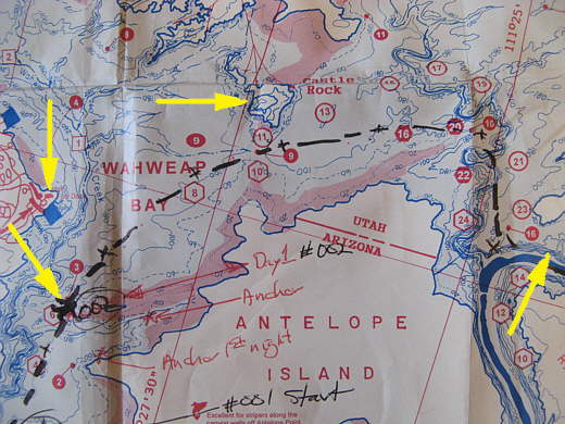
Bottom left arrow is waypoint #002, our days starting point. The arrow above it points to the ramp at the marina. The top middle arrow points to Castle Rock that is so prominent in the pictures on this page. The right arrow points to waypoint #003 our day's stopping point.