--- A Whole 1 1/2 miles Up-Lake - Is Sailing Possible? ---
...............................................--- Sunday Sept. 27, 2009 ---
Day's Starting and Stopping Points Under Sail:
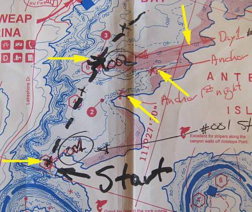
Today's Starting Waypoint #1 = N. 36o 57.322' -- W. -111o 29.125' (The start of the voyage)
Today's Ending Waypoint #2 = N. 36o 58.595' -- W. -111o 28.621'
Night's Anchorage: South side of Wahweap Bay a couple miles above the dam.
Anchorage = N. 36o 58.973' -- W. -111o 28.052'
Today's Progress: Sailed Total = 3 miles -- Up-lake = 1 1/2 miles -- Motored = 6 1/2 milesTotals (see note): Sailed 3 miles -- Up Lake Miles 1 1/2 -- River Mile 5 -- Motored 6 1/2 miles
Note: Each day I'll try and include how far we "Sailed" that day including tacks and reaches. How many miles we made up the lake for the day. How far we "Motored" on the outboard going to and from anchorage.Then below that are the trip totals along with the "River Mile" as marked on the map we had.
"River miles" are confusing on the map as they represent the mileage up the original Colorado River channel which had a lot of bends, some of which you can cut across on the present lake.
The important one for us was the "Up Lake Miles" as that represented our progress up the lake on sails alone. Bull Frog/Halls Crossing, the next place you could take out above Page was about 89 miles away (River Mile 93) and Hite at the end of the lake was about 46 miles past that.
Well this was a very discouraging day and I thought at this point we were embarked on "mission impossible". We motored down towards the dam that..........
........
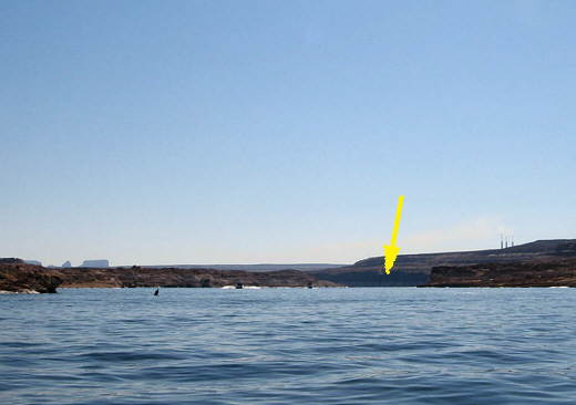
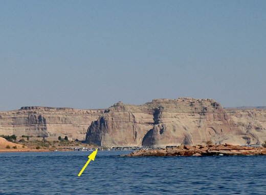
......is down the canyon a little ways past the arrow in the picture above. This part of the lake isn't that pretty and I wouldn't recommend it to anyone unless they are duplicating what we did. Now once you get up lake past the Wahweap Marina it gets very pretty as you will see on the next page and continues all the way up the lake from there.
........
It is hard to make out in the picture above, but there is a point on the waterline at the left side of the picture. The old Colorado River channel goes around behind the point and off to the east (left side of the picture as we are looking south). Back to the left and on the near side of the point in the picture is the way we went back towards the marina and around the north side of Antelope Island. Next to the point was our starting point a little over a mile above the dam. We floated in hardly any wind at this location for about an hour with tour boats (boat in the background) and other boats going by.
........
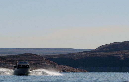
Here is one of the tour boats with a load of people onboard going by with the point in the background to the right of the boat. We finally got a touch of wind and floated and sailed about 3/4's of a mile northeast up-lake over an other hour or more. Very discouraging. Finally we marked our position with the GPS and motored past the ..................
........
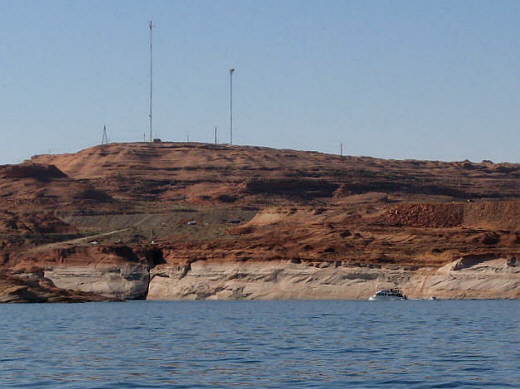
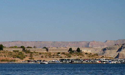
............marina and over to the boat ramp where we docked. I then walked over to the floating store in the middle of the marina. It turned out to be a long walk for 3 loaves of bread. Probably 1/2 of a mile total. We could of moored near the store in a courtesy slip, but we had no idea where it was in the mess of boats all tied up there or any idea how to navigate into that mess.
Back on the Kera Jane we started the Honda and returned to the GPS waypoint where we had stopped sailing and started floating around again. Finally there was a hint of wind or maybe we just wished the boat up another 3/4 of a mile where we again..........
........
.......... marked our position with the GPS as the days ending point for sailing. The marina (arrow) was still almost a mile away. We motored over to the end of the same bay we had been in the night before, but were about 1/4 mile past the previous night's anchorage at the very end of the bay. This was an attempt to escape all of the houseboat generated waves that had not been fun the previous night.
We had burgers on the grill and thought about the 1 1/2 miles of progress we had made in the entire day. At this rate it would take us about 100 days to get to Hite and there would be snow on the ground. I'll have to admit I'm usually pretty optimistic, but not that night. Ruth thought had her usual optimism going for her and was supportive in not wanting to give up this soon, so off to bed we went.
........
The left bottom arrow is the starting point of the trip (waypoint #001) a little over a mile above the dam where we headed north on a course that would take us past the marina and around Antelope Island to the north. The top left arrow is the short distance to our stopping point (waypoint #002) the first day with little wind.
The bottom right arrow points to where we had anchored our first day when we just put in and motored over to that point and anchored for the night. The middle right arrow points to where we anchored the second night after our first day of the trip. The top right arrow points to a shaded red area. With the lake about 60-80 feet down from "full pool" level all the red areas in the lake would be land on this trip and out of the water. This will be true for all the map pictures I'll post.