..........................................--- Into the Eye of the Storm ---
..............................................--- Tuesday Sept. 29, 2009 ---
Day's Starting and Stopping Points Under Sail:
Today's Starting Waypoint #3 = N. 37o 00.336' -- W. -111o 23.769'
Today's Ending Waypoint #4 = N. 37o 01.242' -- W. -111o 19.404'
Night's Anchorage: Side bay off the east side of South Padre Bay near Boundary Butte.
Anchorage = N. 37o 00.186' -- W. -111o 18.677' -- Waypoint #5
Today's Progress: Sailed Total = 7 1/2 miles -- Up-Lake = 4 miles -- Motored = 2 milesTrip Totals: Sailed 19 3/4 miles -- Up Lake Miles 12 -- River Mile 17 -- Motored 9 miles
We were up before the sun at 6:45 a.m. and after breakfast we were able to motor out of the little cove on the outboard. Even getting up early it still seems to take us an hour or more to actually be underway.
........
Back in the lake at the waypoint we had marked the night before we started to run up the lake in a light west/southwest wind using the main and jib. We soon entered the..........
........
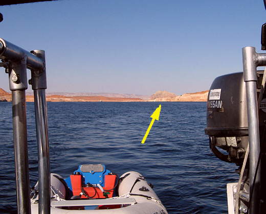
...... narrower channel. We had replaced the genoa with the jib in anticipation of the winds that were predicted, but at this point with sunny skies, light winds and the temperature rising we could hardly imagine what was yet to come. We were running between low canyon walls on both sides and the lake was only about 1/4 to 1/3 of a mile wide here. I use the word "running" kind of liberally as we were only making a knot or so in the light winds, but finally....
........
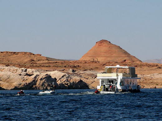
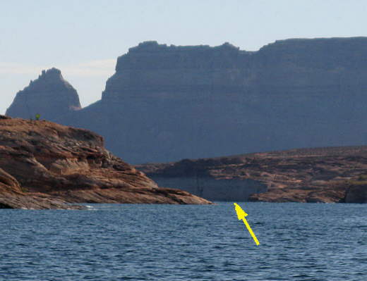
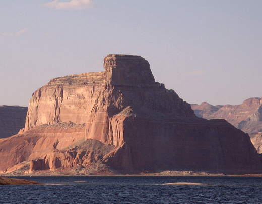
........ about 2 hours later we exited the narrower canyon (arrow) and reached an area where the lake started to widen again with a smaller part of Padre Bay about 2 miles long heading off to the south and the much larger Padre Bay proper heading north for 5-6 miles. Padre Bay gets its name from a crossing of the Colorado River that the Domínguez and Escalante Party used in November of 1776 to cross the river that is now at the bottom of Lake Powell. After moving out into the bay a ways we ran out of wind and were just floating again with various houseboats and others passing by us.
........
Finally we could see in the distance waves forming to the east of us and surmised they were being kicked up from a wind from the east and sure enough a few minutes later a pleasant east wind arrived and we took down our running gear (the preventer & whisker pole) and started tacking to the east. Looking back on it this shift from a west wind to no wind and then an east wind should of warned us of things to come.
We tacked east for 1 1/2 miles and were about 200-300 yards north of two small rock out-cropping islands in the middle of the lake when the wind died completely again. We started to drift towards the rocks and got to within 50-75 feet of them. Then just as I was about to start the outboard the east wind started again and we moved back off the rocks a couple hundred yards and then it stopped again. Then it was dead still for a couple minutes.
........
The next thing we knew we were hit with what felt like a wall of wind from the south. I would guess that it was somewhere between the 20-30 mph that had been predicted or more. It wasn't a gust, but we felt as if we were in a wind tunnel and someone threw the switch to on and then went to lunch. Instantly the waves were up and whitecapping. We had only been on the water about 30 some odd days at this point in our sailing careers and even though we had experienced conditions that frightened us before this was a couple levels higher than any of the other experiences.
We felt lucky that due to the initial angle of the boat to the almost frontal hit of wind it just heeled severely and didn't come close to being knocked down. We released the sheets to the sails and Ruth worked at getting us into the wind, but that was pretty hopeless as we had lost forward momentum, but we were somewhat into the wind as the Mac did a pretty good job on her own.
I lowered the jib and strapped it to the pulpit quickly as the main luffed wildly in the wind. Next the main was lowered. Looking around to see if we were in any immediate danger and finding none the main was raised enough to attach it at the second reef point and pulled back up.
Next we found we were back to having the same problems we had on our first sail on McPhee Reservoir and that was that with a reefed main and no jib up we couldn't get the boat out of the irons and under way (we need to get a storm jib). We could of used the outboard to bring her about some, but the winds were still high and since the weather report had said they would only get higher once they started we dropped the main again.
About this time we noticed the wind was tearing the jib loose from the single strap than had it held to the inside of the pulpit on the starboard side. Fearing it was going to end up in the lake I went forward and re-strapped it and tied the jib halyard at the top of the sail to the pulpit also.
With the outboard running we ran south into the waves with spray coming back over the boat and into the cockpit. Running into the south part of Padre Bay we were hoping to find a small east-west cove on the west side of the bay that would give us some protection from the southwest and northwest winds that were forecast for the next 24 hours or so. About 1 3/4 miles south we found a smaller bay off to the west, but it was wider than we were hoping for, but looked like it might be our best option anyway. We ran 1/4 mile towards the west end of it hoping to find shelter at its end, but the only thing to be found there were sloping smooth rock walls with not enough room to anchor and nothing to tie to. Back out of the narrow part and into the wider part of this side bay we ran south a few hundred yards to what appeared to be shallower water there.
Ruth stopped our south approach to the shore there with the reverse on the Honda and as the wind started to push us back north I dropped the Bruce in about 10 feet of water and let out enough rode so that hopefully our scope would be such that the anchor would hold, but still not let us swing into shore if the wind came more from the north.
........
In some shelter now vs. the open water the winds were pretty steady out of the south at about 20 mph according to the anemometer with gusts higher, but were suppose to shift to the west and then the northwest over the next 24 hours. The shore was wrapped around us on the south and west sides about the same distance away. I really wanted to somehow get a shore line to shore and tie the Kera Jane to some rocks that were to the west anticipating the wind shift to there. We would be in a safer situation with two lines on the bow or at least that was the thinking.
The problem was how to get the line to shore as the wind was coming from the shore to the south and I worried about trying to paddle there in the Zodiac and not making it and getting swept by the wind past the boat and to the north shore a couple miles away with no way to get back. That would not be good. We had bought 200 more feet of premium 3/8 inch anchor line from West Marine and Ruth had made a bag for it. I took it and threw it into the inflatable. Next, so I could have a safety line to the Mac, we rigged some yellow poly line to the inflatable and tied the other end to the Mac and then Ruth fed it out as I started towards shore making very slow progress into the wind. That didn't work well as when I was about to shore I ran out of rope and didn't dare untie it, so it was back to the Mac.
Next we attached the poly line to the dingy and tied that to the 200 feet of 7/16 anchor line we use when tying the stern to shore and I set out again paddling like a mad man into the wind. This time after probably 10 minutes of paddling like hell I was within 20 feet of shore, but could go no further. The line had sunk and gone under the Mac and was fouled around the centerboard that was partially up, but not all the way up. So it was back to the Mac yet again. Onboard we were able to lower the centerboard, untangle the line and pull the centerboard all the way up this time.
........
We ditched the poly line and ran the 7/16 anchor line out over the bow and I tried again to get to shore with Ruth letting out the line as I needed it. Between the wind in my face and the drag of the line going to the Mac it was very hard going, but there was no way I would of attempted this without the safety line attached to the Mac as the dingy was like a snowflake in a blizzard and it could be blown back past the Mac faster than I could of paddled her.
Finally making shore I left the 200 feet of 3/8 inch line and bag in the dingy and started to walk the 7/16 inch line I had used as a safety line around the shore to the west. I reached the end of the 200 foot line and was still short of the rocks I hoped to tie to. I tied the end of the line to a small loose rock nearby so it wouldn't disappear back into the lake a few feet away and returned to the dingy for the 200 feet of 3/8 line. I then tied that line to the other one that was running out to the Mac and proceeded to the rocks I hoped to use only to find out that they wouldn't work. I saw more rocks another 75 feet or so to the north and was able to tie to them. Now the Mac was on the anchor with one line and about 300 feet of shore line also holding her to some large rocks. Both the lines went through the chocks on each side of the bow and were tied to the bow cleats also on each side of the bow. We were very happy that we had spent the money on some good 3 twist anchor line and had ditched the cheap poly lines and this wouldn't be the last time on this trip that good anchor lines would prove to be worth every penny we spent on them.
I returned to the dingy and since the Mac was directly downwind I, probably foolishly, decide to take a chance and float to it with the wind at my back pushing the dingy. I kept the dingy aimed in the "V" that was formed by the anchor line one one side of the bow and the shore line on the other side. Upon reaching the boat I held onto the life-line on the starboard side and worked the dingy and myself back to the cockpit and attached the dingy to its line and climbed over the side and into the cockpit exhausted. During all of this the wind never let up at all and was now averaging close to 25 mph on the wind gauge.
........
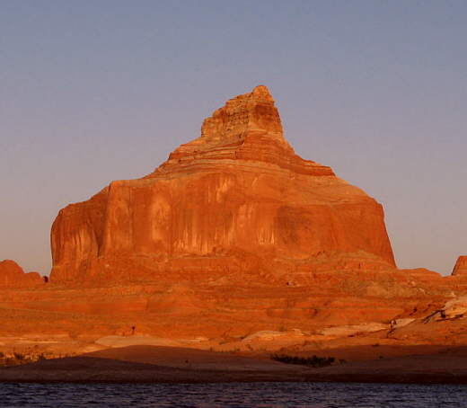
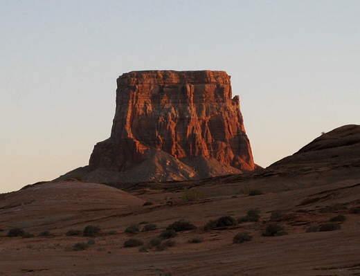
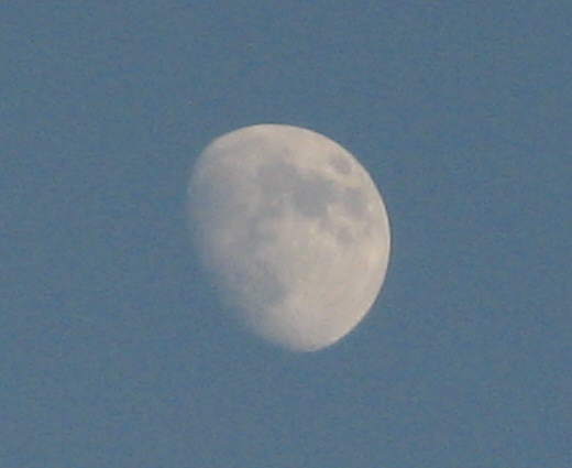
The Mac seemed to be very secure. I took some time to take some sunset pictures of the nearby buttes and after dinner under almost a full moon we were in bed by 10 p.m.. The winds died about 2 a.m., but we would only get a 4-5 hour reprise from them before they returned with even more force and from a new direction, but for now we were safe and the Kera Jane came through for us once again.
........
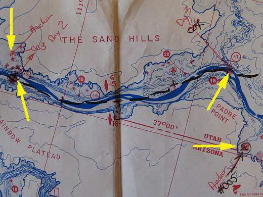
The top left arrow points to the previous night's anchorage and the shoreline on the map doesn't show the very small and narrow cove we were in. The bottom left arrow was the days starting point (waypoint #003) and the top right arrow is our stopping point (waypoint #004), where the wind came up and we quit and motored down to the night's anchorage at #005 (bottom right arrow).