--- Naples and on to Little Marco Island Channel ---
.......................................................--- March 16, 2011 ---
Nights Anchorage: 026o 00.750' N -- 081o 45.739' W -- By Little Marco IslandTrip Odometer: 107.7 miles
Days Mileage...: 38.3 miles
We were up early as the less time we spent thinking about going out into the Gulf and heading 20+ miles south to Naples the better. In retrospect I guess we were pretty big wimps worrying about this passage as hundreds of people have been out in the ocean in the same size or a lot smaller boat that what we were in, but still the apprehension was there. Not really fear just kind of like the first time you have to speak in public. Not something that you are going to die from, but something that can twist the old stomach up a little.
........
It was a beautiful sunrise and the weather called for light east winds with only a 1 foot sea. Perfect time to go. Well after getting the 2 anchors up. One bad thing about a Bahamian Moor is that you can get your anchor lines twisted and that is what happened. We later learned how to deal with this better, but it took a few minutes to get both anchors up and headed out the channel and to the Gulf just a short distance away.
........
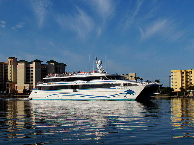
While we were dealing with the anchors the Key West Express passed us. When we later returned to Ft. Myers Beach I learned more about this option to going to Key West. It is a high speed 170-ft. catamaran that makes the trip down to Key West in the morning in 3 1/2 to 4 hours and back again that night or I believe that you can go down on one day and back on another. The rates aren't that bad at around $140 per person round trip. Probably cheaper and a lot less hectic than driving to Key West and back from Florida's west coast. Ruth surprised me when she said she would like to do it sometime.
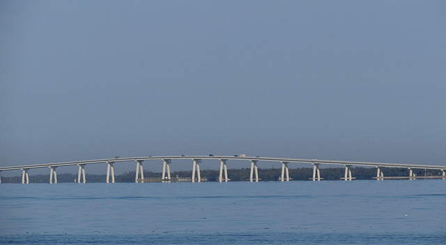
Ok lets get back to traveling in the slow lane. We made it back out into the Gulf with no ....
........
.... problems and took one last look back at the Sanibel/Captiva Bridge and headed south down the ....
........
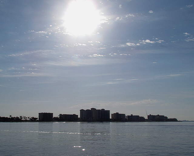
.. the coast after first passing the Ft. Myers Beach hotels above.
........
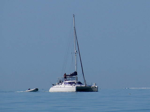
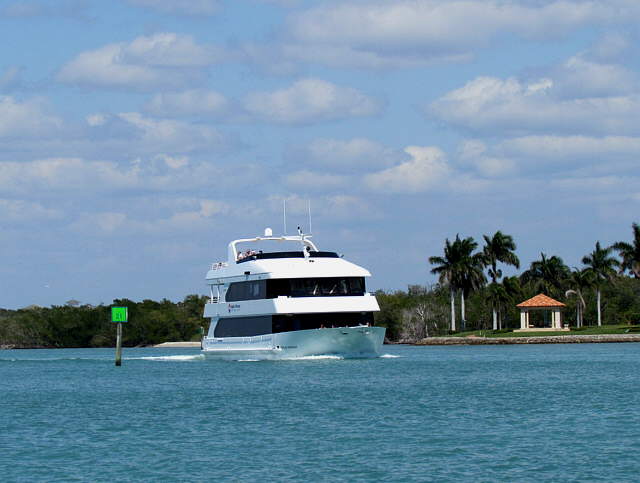
This cat was headed north as we went south. As you can see ......
........
.... we were out in really dangerous conditions
........... so dangerous and the wind so high that we didn't even dare raise the sails. Well one more 'anticlimactic' experience under our belts. Ruth wasn't disappointed though and headed us south ...
........
... about 1-3 miles off shore as the coastline curved in to the east and away from our track ...
........
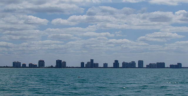
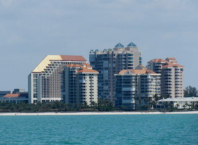
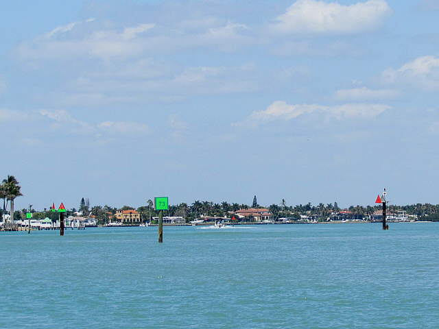
... still this didn't stop the 35X power Cannon from capturing some pictures of the shoreline highrises. The wind finally came up as we approached Naples and turned into the cut there but didn't present much of a problem going in and the current wasn't that bad either, but noticeable.
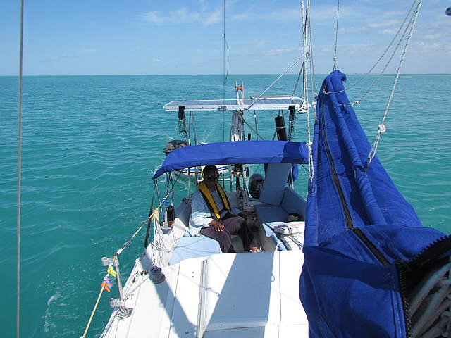
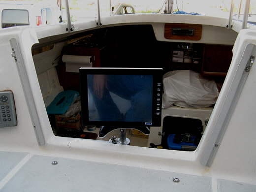
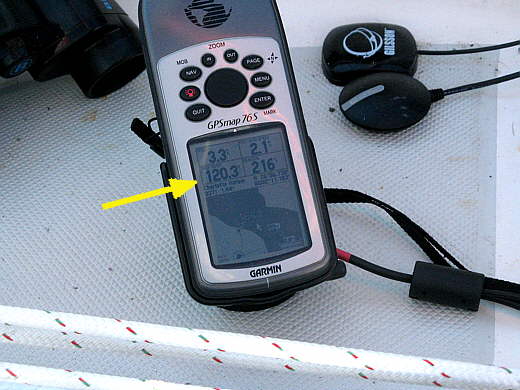
The biggest problem can be finding where to go in at. The shoreline all looks the same and when you are out there 1/2 mile or more to avoid the shallow water it is very hard to make out where these inlets are the first time you are there. I strongly, strongly recommend plotting your course on a GPS or chartplotter. We have the SeaClear II running on the computer/monitor/chartplotter below all of the time and I can see that monitor from the companionway...
.................
.... That computer is hardwired to the.....
.................
.... handheld Garmin Map 76S in the cockpit that Ruth and I can both see. The waypoints are on the handheld and it is easy for Ruth to see if she is on course to the next one or not. Also if we want to do a course change I can drop below and plot a new or modify the course in just a minute or so with SeaClear and send the new waypoints in seconds to the handheld.
We always knew where we were and where we needed to go. Very important when almost every day you are navigating shallow water and are faced with new surroundings that you have never seen before. It takes a lot of the anxiety out of going new places. One thing we never worry about is how to get to the next destination course wise. We have full size paper charts on board, but they would be very hard to use in Florida where there are so few identifiable landmarks.
........
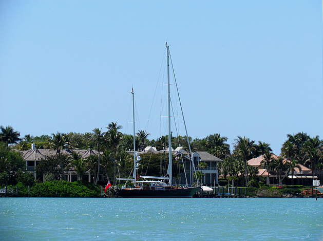
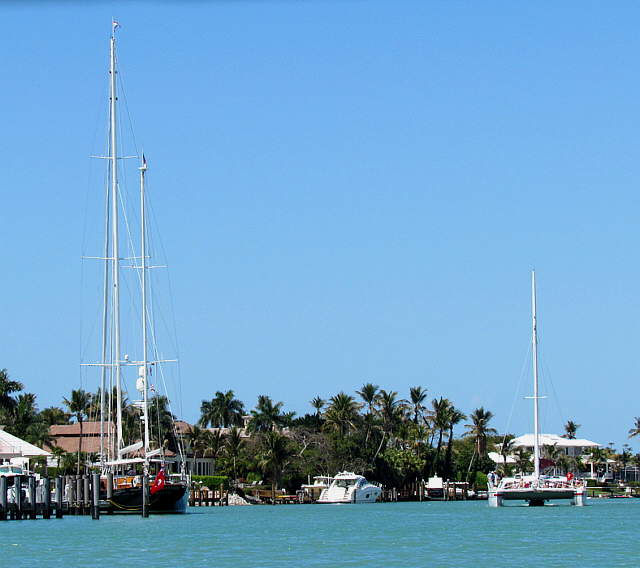
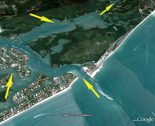
Once inside the Gordon Pass Cut we found ourselves in a rather narrow channel with lots of boat traffic. Other sailboats, power boats and probably worst of all a number of rental pontoon boats manned by people with even less experience on the water than us. We kept to our side of the channel maintaining a comfortable speed for us and gawked at the very expensive homes and boats tied up in front of them.
........
The channel winds around some with one alternate dead-end route into an anchorage that some use, see chart below, but that we passed up as if we can avoid it we don't like to anchor in someone's front yard so to speak.
........
We weren't the only ones gawking at the houses. It is kind of like Hollywood in a way except here you take a tour boat vs. a tour bus to look at the homes of the wealthy. Ruth thought it was a little intrusive, but I noted that a lot of these people like the fact that they own a house that someone wants to look at. I appreciate people looking at my Street Rod.
........
About a mile in you have a decision to make. Turn to port and go up to the downtown area of Naples and some possible slips there and maybe an anchorage or so on the way or turn to starboard and head south on the inland waterway that connects Naples to Marco Island to the south.
........
We are kind of western introverts so chose to make the starboard turn and head away from the congestion of Naples. That is not to say away from other boaters as this waterway is very popular and there was a lot of boat traffic and a lot of it was faster than we were.
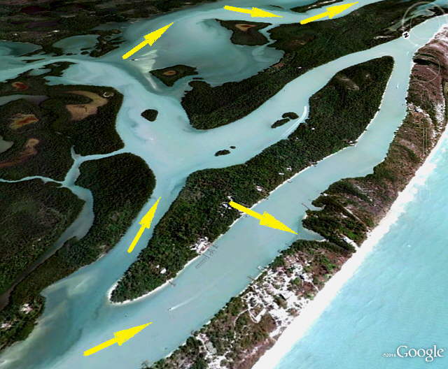
I had seen an area just a little ways to the south and off to the east that I thought would be a nice place to anchor, but the charts showed no depths. We turned off the marked waterway and proceeded into the area only to find it becoming very shallow very fast. We turned back towards the channel and ran aground. Now remember we only take about 18 inches of water. The rudder kicked up. We had the swing centerboard hauled almost all of the way up when this happened. Finally we were able to back off some and move a little over in the direction we had come from and made it back into the channel and take off south again.
Now I decided that we would go to a 'know anchorage' that I had read about in Guide to Anchorage's in Southwest . This book is out of print, but we found a used copy and you can now download the whole book on the Internet ( HERE ). I would do that pronto just in case it disappears off the Internet as is is the best resource we found for anchorage's on the west coast.
We did also use Claiborne S. Young's Cruising Guides: Cruising Guide to Western Florida but for our type of cruising found the Guide to Anchorage's in Southwest Florida more useful. We did find Claiborne's Cruising the Florida Keys to be our best single resource when in the Keys. We had other publications also with us but used the one the most on the West Coast and the other while in the Keys.
Well with a destination in sight and trying to stay out of everyone's way who was faster than us the best we could we headed about 4 miles south to a side channel off of the waterway on the west side of Little Marco Island. Finally some peace except for a couple people holding water drag races with a couple jet skies. For some reason the jet ski with 2 people on it always lost and the gal piloting the other one seemed quite please with herself until the passenger moved over to hers and she lost.
It wasn't terrible, but we enjoyed the area around Naples and to the south of it a ways on the waterway the least of any place on the trip due to the narrow channel and the amount of high speed water craft, even though there were a couple of 'slow manatee' stretches. It was pretty, but too busy for us.
Again we anchored on a Bahamian Moor off to the side of the channel where the spit of land between us and the Gulf was very narrow. The problem in anchoring in places like this is that even if you don't put out much rode you can still swing out where people are traveling at high speed on jet skies and other small craft or you can swing into shore or shallow water. We got to where we could put down a Bahamian Moor in less than 5 minutes and if we didn't get wrapped up get off of it in the morning in about the same amount of time.
Despite all of the boat traffic around Naples it was a great day on the water and we got one more 'never did that before' out of the way. Only one left, 'being out of sight of land'. This would have to wait for another week or so. We went to bed happy boaters. I'd like to say 'sailors' except we motored all day.