.........................--- Fanny Keys to Gulf Side of Long Key ---
...............................................................--- April 20 and 21, 2011 ---
Nights Anchorage: 024o 48.699' N -- 080o 49.969' W -- Long KeyTrip Odometer: 341.6 miles
Days Mileage...: 25.1 miles
With the news about having a holding tank being a requirement in the Keys Sanctuary according to the people at Boot Key we had to decide what to do about the rest of our trip. As a side note I think that they can require it for a boat using their mooring, but I no longer think and didn't think at the time it applied to us. The main reason is that the MacGregor we have is actually 25'-10" long and not 26 feet and a lot of the regs. apply to a boat over 26 feet in Florida in general and the Keys. That doesn't mean that you can dump, but that you have different options to meet the law under 26 feet vs. over.
After I read the Keys Sanctuary Regs. more I felt that we were complying with them, but also realized that we could be ticketed by law enforcement and then might have to go to court to make our case. That wasn't an option we wanted to explore. We also had to take out just after the 1st of May in order to go over and close on the Endeavour we had put a deposit on. So instead of turning south further into the Keys on the Gulf Side we started to work north on the Gulf side and we really enjoyed the part of the trip coming up.
........
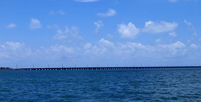
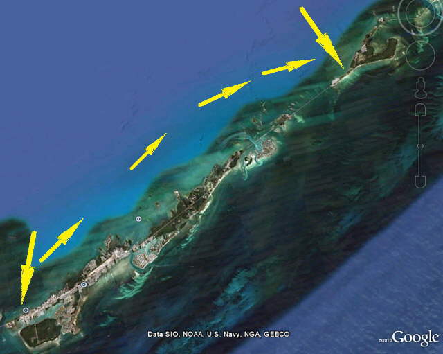
We headed northeast following the ICW markers for the most part. We left Long Key and Duck Key astern and then passed the Long Key Viaduct off to starboard. Just past it we turned...
........
.... in towards an anchorage that I found looking at the charts. The houses above were at the north end of the viaduct and we anchored just...
........
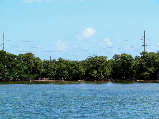
... to the north of them by about 1/2 mile. I was able to connect to the Internet here also as we had been able to at a number of places on the trip with our long distance WiFi.
........
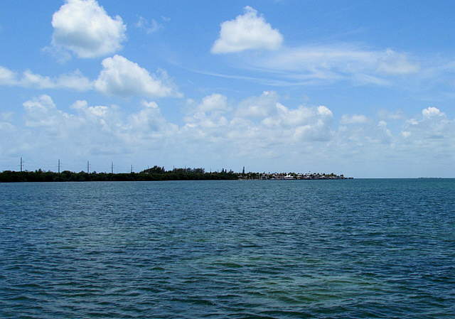
We weren't too far off shore and the winds had been and were still suppose to remain coming out of the east, so the Keys were pretty sheltered on the Gulf side. We were lucky and never experienced west winds while on the Gulf side. The prevailing winds are east winds, but can clock around if a front goes by to the north.
........
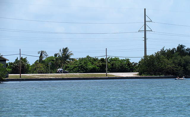
It was a couple hundred yards over to the Keys Highway, but we never went ashore here. Sometimes it will be way past a week between our shore visits.
........
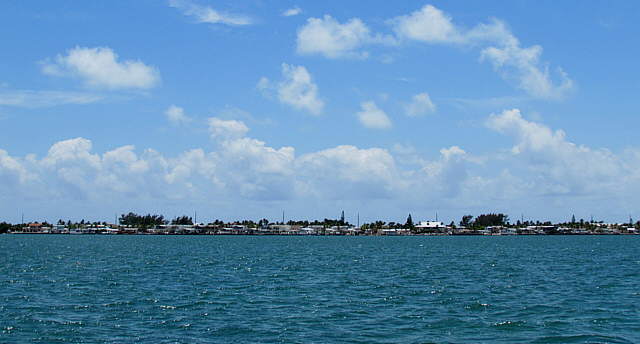
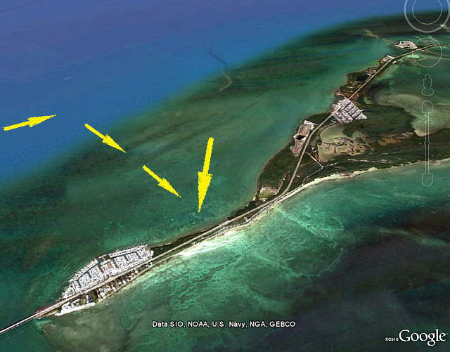
The view above is Long Key on the Gulf side. Since it widens out just past this anchorage it provides the anchorage with a little wider window of wind protection.
........
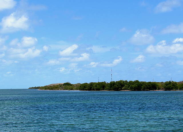
Since I take a lot of the shots with the telephoto it sometimes looks like we are closer to things than we are, for instance the picture of the highway a couple pictures up. Here you get a better idea of how far off shore we were. We only had one anchor down here and you can see that if we can we put out a lot of rode to decrease the scope and we just don't drag.
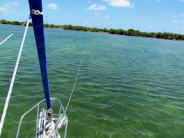
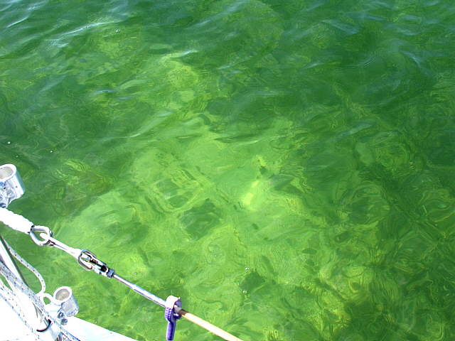
We were unsure about anchoring where there was grass and didn't even know if the stuff on the bottom is grass or something else. With the water being so clear Ruth would take us ahead and I'd look for an opening on the bottom that was just sand and then drop the anchor there.
........
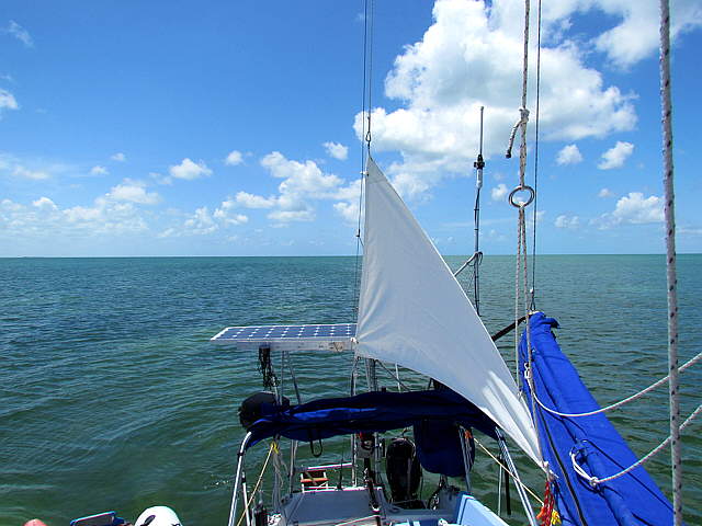
We usually put the anchor sail up, something else to keep me busy. Not sure why I had it tied off to port here as usually I tie it off to starboard.
........
Above you can see how clear the water is and how easy it is to see if you are putting the anchor down in sand or not. I need to find out more about what is actual sea grass and more about anchoring near it before we return.
........
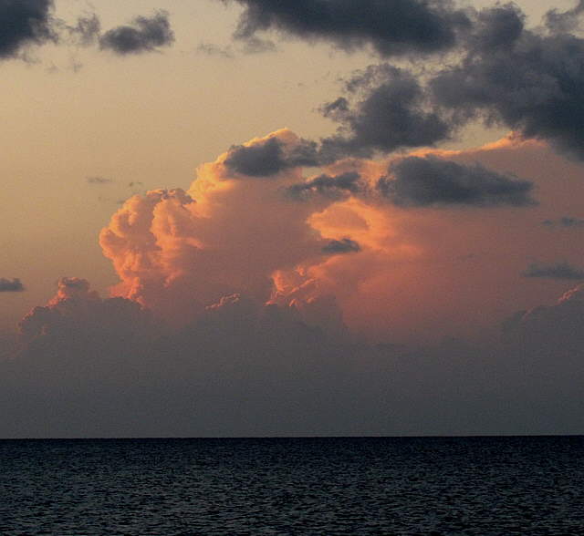
Thunderheads building to the north and west of our anchorage.
........
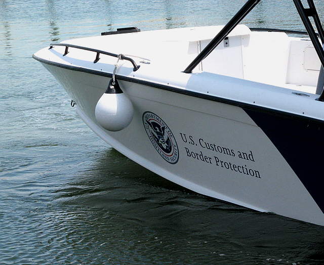
We were on this anchorage all alone and I was on the computer and we were sitting there peacefully when all of a sudden I realized that Ruth was talking to someone. The U.S. Customs guys we had seen a few days earlier at Keys Fisheries in Marathon had come along side of us and I didn't even hear them. I'm hard of hearing, but still their boat can be quiet.
They wanted to see our registration and prove of U.S. residency. I put these right were I could find them, but then of course couldn't find them. The wind was blowing pretty hard (picture above was from Marathon) and they kept banging into our boat. They tried with not much success to put a fender between us but that wasn't helping. We had give them our passport cards and I was trying to find the registration papers and they were getting more embarrassed about repeatedly hitting our boat. About the time I found the papers and before I could show them to us they pushed off and said to forget it. That was the last we saw of them.
........
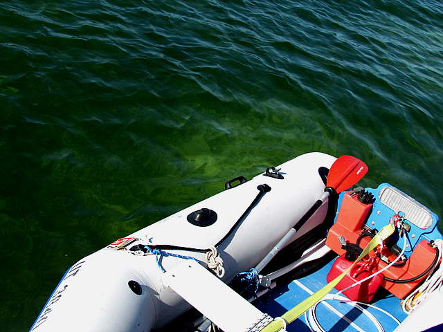
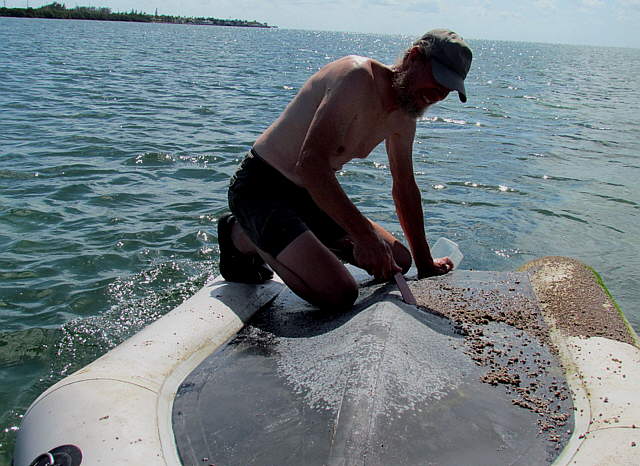
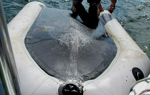
With our visitors gone and not receiving new ones we turned our attention to cleaning the bottom of the dinghy that we had last cleaned over at Whitehorse Key in the 10,000 Islands. Over there we had taken the dinghy to a beach and turned her over. Here we tried something new.
........
I emptied the dinghy out and flipper her over next to the Mac and climbed aboard.
........
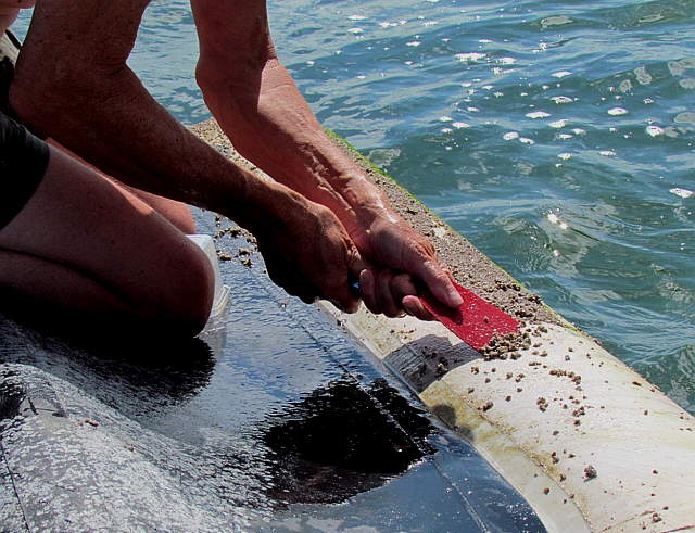
I found that a plastic spatula worked really well for scrapping the ....
........
...small barnacles off and I was done in about 30 minutes. This proved to be easier than on the beach actually where we did the work standing next to the dinghy.
........
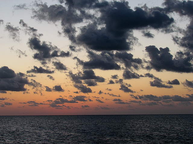
The end of one of the two days we spent anchored just off of Long Key.