.........--- Sitting Around and On To Captiva --
.--- Wed./Thurs./Fri. - Dec. 1st, 2nd and 3rd ---
Day's Starting and Stopping Points:
Today's Starting Waypoint = 026°41.160 N -- 082°14.384 W
Today's Ending Waypoint = 026°30.491 N -- 082°11.158 W
Night's Anchorage: Roosevelt Channel between Buck Key & Captiva Island
Anchorage = 026°30.491 N -- 082°11.158 W
Wednesday, started in the middle of the night with winds in the high 20's and low 30's and the anchor sail's clew line banging around on the corner of the pop-top as explained on the preceding page. We sat around on Wed. and also on Thursday as it was cold and windy, but not as cold as what we would soon experience.
We can't believe how fast these days go by even though we aren't doing anything. By the time you eat and clean up a little and mess on the computer or read the day is over and with the short daylight you don't feel like staying up real late. Even though we had only moved a couple hundred yards we lost our WiFi due to the trees that were between us now and Boca Grande. We usually listen to the NOAA weather forecasts a couple times a day and if we can hook up to their web site for detailed wind predictions. For these couple days we just listened on the VHF for the weather reports.
Since not much else happened over these two days I'll post a couple more pictures of how we live aboard this small boat. If you are only interested in the run to Captiva skip down the page a ways.
........
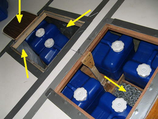
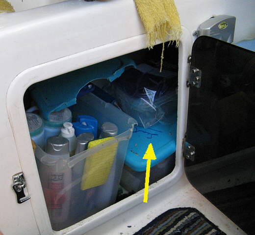
We started the trip with 6 of the 4 gallon Reliance containers shown above under the V-berth along with two 7 gallon ones just aft of these under the extended part of the v-berth.
........
Then we had the one above (left arrow) and the two one gallon containers (bottom right arrows) also filled for a total of 44 gallons of water at the start of the trip. To save you the trouble of looking we had about 14 gallons left after being out for 25 days, 4 of which were off the boat on Captiva. We could of used less per day, but we saw we weren't going to have a problem, so got a little sloppy towards the end.
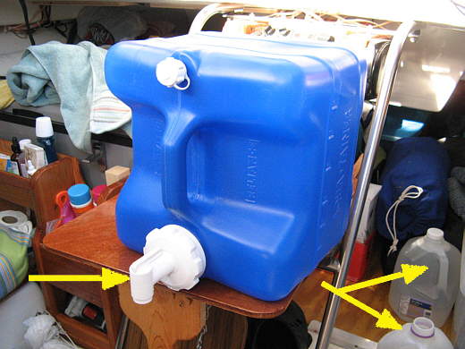
We have one of the 7 gallon containers hooked to the sink and used that mainly for washing our face in the morning and for washing dishes. We used the 1 gallon for cooking and drinking as it was quicker and easier to pour from them vs. pumping from the sink. When they were empty we would fill them from this 4 gallon container like above where is is sitting on the "handy place anywhere table". The spigot (left arrow) unscrews and then re-screws to the inside of the cap. That is handy.
When we have used up the 4 gallon container or the 7 gallon that is attached to we pull out the 12 volt transfer pump and prop a cushion up on the bed so that I can get to the other containers under the V-berth. I then pump from them and fill the 4 gallon, the two 1 gallon and the sinks 7 gallon. Then we are good to go for another 7 days or so before repeating the procedure. I take water from those under the V-berth in a manner that keeps the boat balanced in the water. All of this has worked very well for us.
........
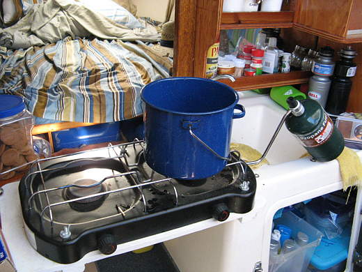
We wash our faces every morning with cold water to wake up and get a little cleaner. Then every couple days we take a sponge bath, actually use wash rags, and wash each others hair. If you are care full you don't need much water. We heat some water on the stove (above).
........
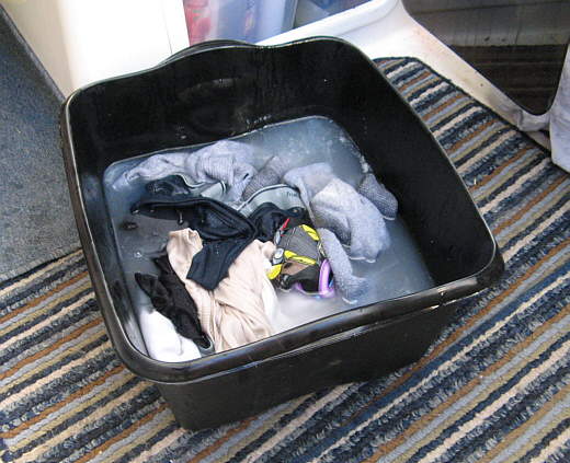
We put our dirty cloths in a tub. While we wash our hair and rinse it you have the tub in your lap and your mate pours the water over your head and the water goes into the tub. When done wash the cloths and rinse them and hang them on the life lines. Saves lots of water. Important if you are sailing on salt water like on this trip.
........
Since we have plenty of storage for food and food preparation above we keep the cleaning supplies under the sink. Also Ruth has a very extensive supply of medical items after the Lake Powell incident. The arrow points to a container for simple emergencies. There is another under the v-berth where the porta-potty was for more drastic emergencies. She got help on this from our family doctor.
........
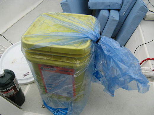
The yellow ex-soap container above has housed our full Double Doodie bags from the head before with no problem. It will hold 6 or about 18 days worth, but on this trip it was emitting a slight odor at times. I think it might of been because the bags where in there longer than before and had started to off-gas. It wasn't bad, but we had this plastic cloths bag on board and put it around the tub and the odor problem was resolved.
A note about the bag. We had others that we had put clean cloths in and stored them under the v-berth on top of and beside the water containers shown in the first picture on this page. We also had my laptop and other electrical gadgets along with cereal and cookies in 1 gallon plastic jars also by and on top of those water containers. A 26 foot Mac will hold tons of stuff, we love this boat.
........
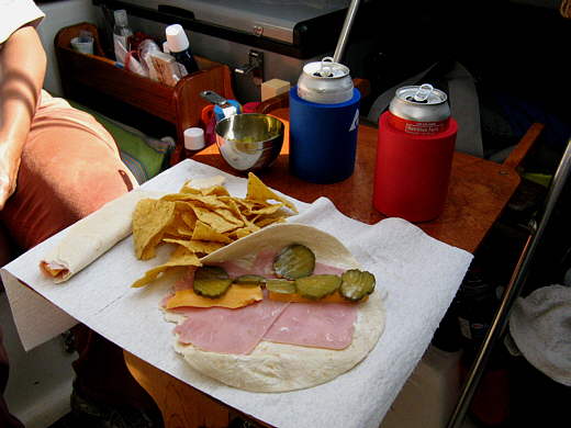
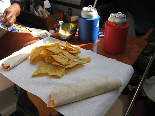
On another note one food item that wouldn't go a long ways without spoiling was bread. On this trip we took lots of tortillas as they stay fresh a lot longer than bread and kept them in the frig. We made what we call 'wraps' with various things in them and really liked them.
........
They were quick and easy to make regardless of if you were underway or on the anchor. On anchor we still usually had our big meal during early afternoon like we do at home.
=================================================================
Ok now for Friday's trip to Roosevelt Channel by Captiva Island.
........
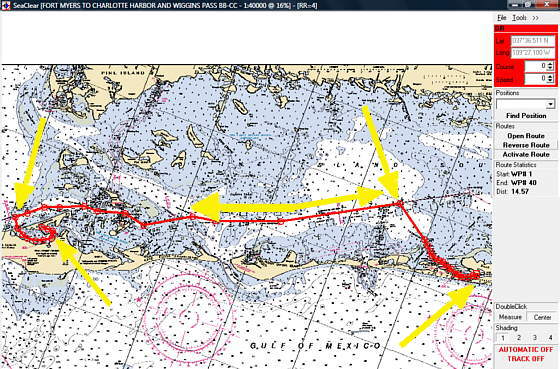
Above is the route from Pelican Bay (bottom left arrow) to Roosevelt Channel by Captiva Island. The route is about 15 miles and we motored most of it, but did sail some off it where the double ended arrow is in the middle.
Note: Most of the 'white' water areas on the charts on these pages are deep enough to sail without having to pay much attention to the depth finder. They are 7 feet or deeper. If you get into the 'blue' areas you had better pay close attention as the water depth goes from 1 foot to 6 feet deep. As you can see there is a lot of 'blue'.
........
The right arrow above points to the south end of Punta Blanca Island which is on the east side of Pelican Bay. The left arrow points to a south approach into Pelican bay. We didn't use that route out of Pelican Bay since the chart shows very shallow water there. I think we would of been fine at high tide, but we just went out the north end and looped back around Punta Blanca to this point on the ICW and continued on south.
........
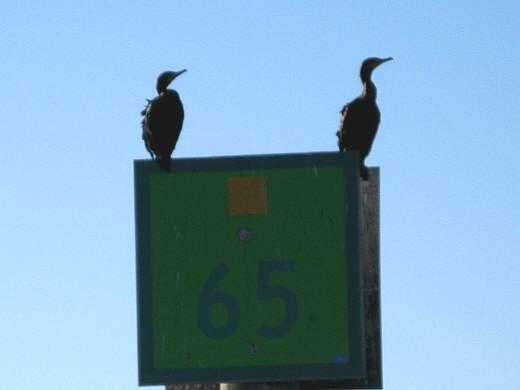
Here we are passing marker 65 on the ICW. Going south on the ICW in this area the green markers are to starboard and the red are to port.
........
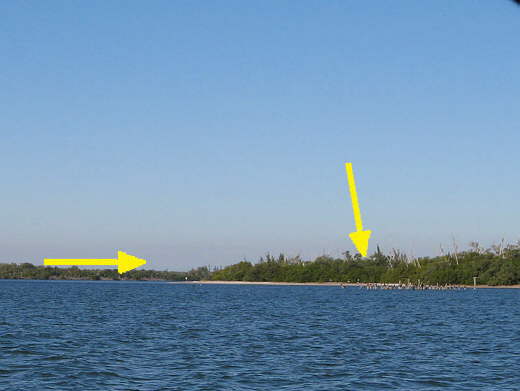
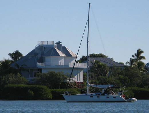
About a mile past the end of Punta Blanca Island we drew abeam of Useppa Island off to our port. Lots of nice homes and it intrigued me from the standpoint of having built 3 of my homes that there is no road to here, so all of the building supplies and such had to come in over water or by air. Also now the owners don't just drive home in the evening. I'm sure most of these people have homes elsewhere also.
........
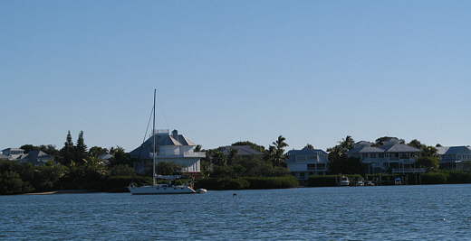
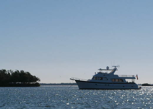
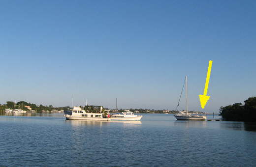
Nice boat and house, but we were on the same water and having a good time.
........
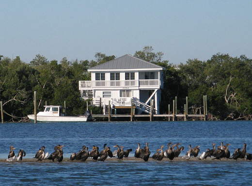
There are birds of all descriptions everywhere you go. These guys were taking advantage of low tide.
........
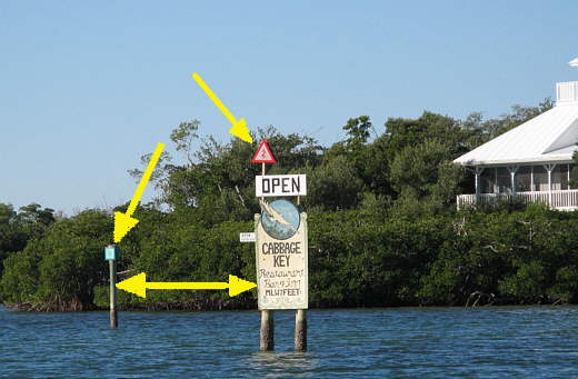
The entrance into Cabbage Key which is just to the west of Useppa on the other side of the ICW. Here going into the channel (double arrow) you want the red to starboard and green to port. I finally remembered the saying "red, right, returning". Once I had that down a couple times things got simpler. If you can read the sign you can see there is a restaurant there that is suppose to be pretty good according to "A Guide To Anchorage's In Southwest Florida". By the way this is a good book for the area and helped us out a lot. The only problem is that I think it is out of print. We were able to find a used copy. Now the good thing is that I just found it on the Internet and you can download it and print it by going ( HERE ). I'd strongly recommend this if you would like to sail this area of Florida.
........
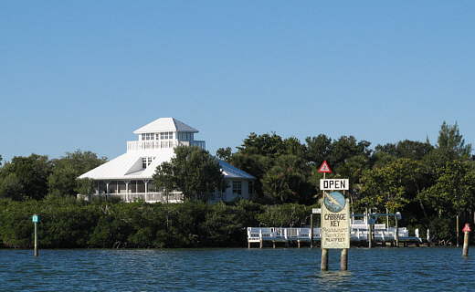
The restaurant and cottages are down past this house a ways. We didn't go in, but probably would if we found ourselves back in that area.
........
Opposite where the last picture was taken is an anchorage recommended in the book above. The only problem with it is that it is pretty exposed and right next to the ICW, so you would be rocking on the anchor as boats passed.
........
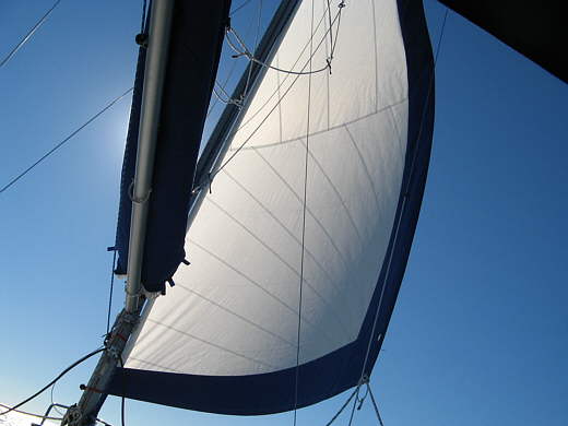
Just past Cabbage Key I let the new 135 radial cut Genoa that we got from Martin at Somerset Sails. We are really happy with the main and the Genoa we purchased from Martin. They were a little more expensive than the cheapest Mac sails out there, but not that much and had features they didn't have. If you need sails talk to him and at least get a bid from him and tell him that we sent you.
With the single sail out we cut the power back on the outboard and then cut it off altogether and sailed for about 5 1/2 miles right down the ICW at about 5-6 knots.
........
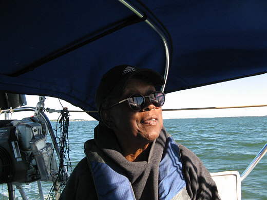
Ruth was on the tiller and I was acting like I was doing something.
........
We soon went past Captiva Pass where if you are braver than us you can exit out into the Gulf.
........
You will find more homes and Safety Harbor there and there again you only get there by air or water.
........
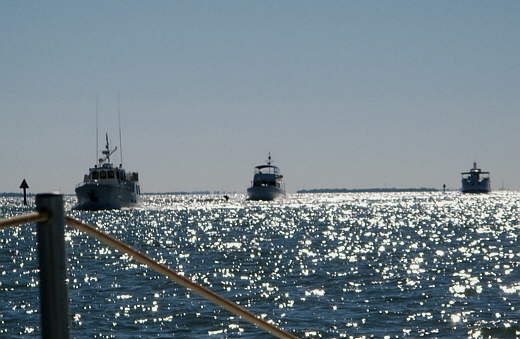
This was one of the few times we saw boats close to one another on the ICW. Due to the shallow water on either side of it most of the boats that are moving from one location to another follow the markers like what we were doing. Usually you had one boat at a time coming at you or passing you.
We sailed on until marker #40 where we furled the sail in and started off to starboard using the Tohatsu looking for the markers that would take us into Roosevelt Channel next to Captiva Island.
........
We picked up the channel markers and followed them on into Captiva. There is very shallow water here very close to the markers at places, so I'd recommend sticking with them. This was a great day on the water for us, but they were predicting strong winds over the next couple days followed by a cold front with the temps dropping into the high 30's.
We decided to try and get a cottage at Jensen's Twin Palm for Monday and Tuesday which were suppose to be the 2 coldest nights. I'd found the place while back in Utah searching the net for a place that we could go into and slip the boat and meet someone who arrived by car to visit with us. Not too many places in this area have that combination. The cottages were a little more a night than what we spend on the road, starting at $145 a night plus $50 a night to slip the boat, but we felt like treating ourselves to something nice and we hadn't spent a dime the preceding 10 days, so we pulled and and tied up. Check with them on rates as they are seasonal and maybe better during the week vs. the weekend.
This is a cute 'out of the 50's' place kind of lost in time. The owners, the Jensen brothers, are really nice guys. They told us the room would be $125 if we took it for 2 nights and $115 a night for 3 or more nights and they would give us the slip free. We booked Monday and Tuesday after looking at one of the cottages. During the cottage inspection I almost fell down walking in the cottage after being on the boat so long. I'm sure I looked like I had been drinking and I was quick to point out to the maids cleaning that I'd been on the water for some time. They probably said to themselves "sure thing".
More on Jensen's later and their rates are seasonal so be sure and check to see what they can do for you.
........
We then left Jensen's (arrow) behind and headed down....
........
...... the Roosevelt Channel almost a mile into the narrower section above (arrow).
........
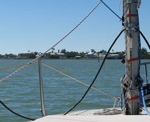
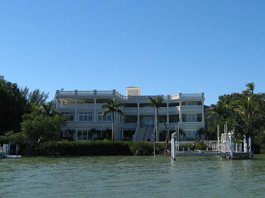
On the way down to the anchorage we passed one of your basic Captiva homes!
........
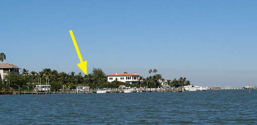
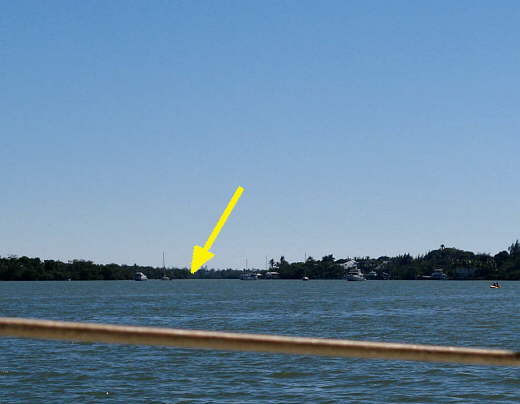
We pulled in just down the channel from these boats and put down two anchors and anchored on a Bahamian Moor for the first time. At first we just put down the claw and drifted south in the light wind. I started to worry about a wind shift during the night and if we would swing out into the channel nearby. So next I let the rode out on the claw about 80-90 feet more and drifted further south paralleling the shore and then put the Manson down there. Next I let its rode out and pulled us back towards the claw so that we were about equal distance from each anchor and cleated them both off.
Jensen's was about a mile back to the north (arrow). Just past this point the channel really narrowed. The marked channel was right in the middle not leaving much room for anchor swing on either side of the marked channel, thus the Bahamian Moor.
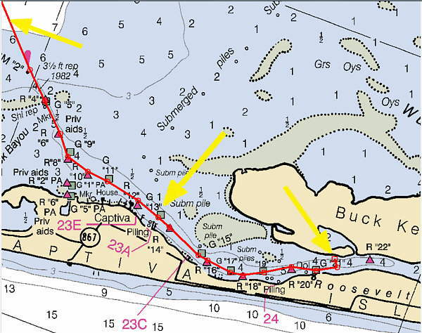
Above is the last part of our route to our anchorage in the narrow Roosevelt Channel that runs between Buck Key and Captiva Island. The top left arrow points to the route coming down from the ICW near marker 37 about 3/4 of a mile above that arrow.
The middle arrow points to where Jensen's Twin Palm is right off of marker 13. The right arrow points to our anchorage just off the channel. There wasn't much room between the bank of Buck Key and the marked channel. It started to widen pretty quick where the other boats were anchored towards Captiva in the picture above this one, but we didn't think there was enough room to move up into where they were. That picture was taken a little wide angle and we actually were about as close as I wanted to get to them as I couldn't tell how they were anchored.