..........--- 25 miles to Pelican Bay --
...................--- Sunday - Nov. 28th ---
Day's Starting and Stopping Points:
Today's Starting Waypoint = 026°56.426 N -- 082°11.721 W
Today's Ending Waypoint = 026°41.160 N -- 082°14.384 W
Night's Anchorage: Northeast side of Pelican Bay
Anchorage = 026°41.160 N -- 082°14.384 W
We were face with a dilemma as to if we should sit tight where we where or move on the 25 miles to Pelican Bay. Between where we were and there were very few places, actually none as far as we knew, where we could slip into and spend the night. The wind was suppose to be out of the NE, so should be behind us and it was only suppose to get worst over the next couple days as a cold front, the first of many, went through. We decided to go.....
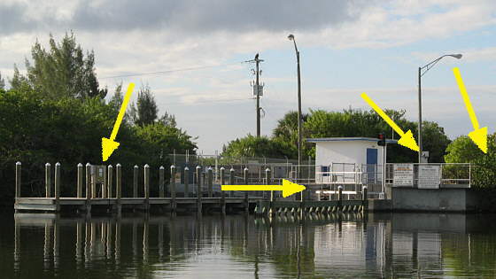
Our first obstacle though was getting through the lock. We still aren't very good getting the boat to go where we want in these, for us, tight situations and the darn pilings were a further problem. To work the lock you have to first pull up to the control box (left arrow). Then pull down and hold down a chain with a ring on the end of it until the lock door opens (bottom arrow). Next you pull into the lock and stop at the second control box (second arrow from right). You hold it down to the lock closes and the other door is fully open. If you let up on it everything stops.
One problem is there isn't much to hold onto except pretty much the ring and once the boat starts to swing out that is hard to hold onto.
Finally you stop at outside the lock at the dock there that is like the one above and catch and pull yet another ring to close the lock door behind you before you leave. Well on that side I didn't have us slowed enough and when I reached out with the boat hook to grab the ring and did so the end of the boat hook just broke off and we kept going with the hook hanging on the ring. I was able to back up and retrieve the hook and close the door. Later I was able to take the broken part of the hook out of the handle and grind down the hook and pound it back into the handle. Then I used one of the two battery operated hand drills to drill through the handle and hook and insert a 1/4 inch bolt through both. It is stronger now, but it will be used with more caution in the future.
Once out of the lock we were in a very narrow 30-40 foot wide channel that was well marked with the red/green markers along the sides for the first 1/4 mile or so.
........
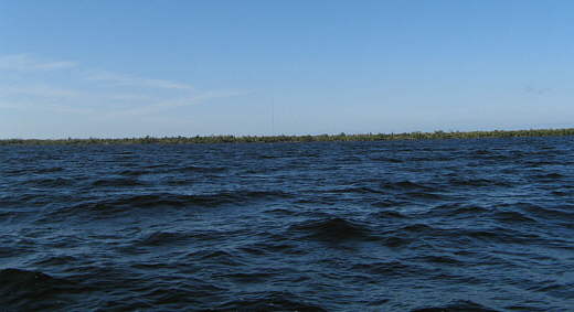
Almost as soon as we got out into the bay past the channel we knew this was going to be a different situation than on the lakes we had been sailing. On some of them it was a ways to land, but with the nearby mountains or canyon walls you could always see land in the distance. That wasn't the case here. When we pulled out into the bay and started motoring south we could see land on three sides, but not ahead. To us it looked like we were headed out into the ocean.
Also the wind wasn't exactly as predicted for the day. It was already higher and more from the east which brought the waves in on our port beam and the boat would really rock as they went under and past us abeam. Somewhat like we had experienced on Lake Powell when house boats went by, except these just kept coming.
........
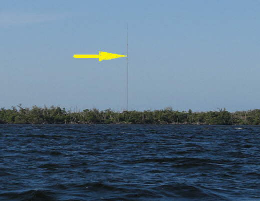
After about an hour we saw the radio/TV tower inland about 1/2 mile to the west where we had anchored just off the canal system there. At least we were slowly moving south at about 5 1/2 mph not pushing the new outboard very hard.
........
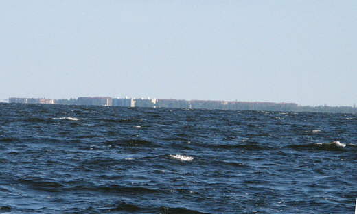
Further south we could see condo's or something off to the north (telephoto shot above). The waves just kept coming and Ruth went below for 2 minutes or less, but that was all it took for her to become seasick. We had been eating ginger snaps, but they didn't work well enough for her. I tried to keep her looking off into the distance and tried to get her back on the tiller, but that just wasn't working. I was surprised that I wasn't sick myself.
We had the center board about 1/2 way down where it usually is when we motor and I'd thought about trying to put the main up or letting the furler out as I'd heard that helped with the rolling in this situation, but I didn't need further complications and I would have had to do everything by myself as she was only getting worst.
Finally it got bad enough that she got rid of breakfast over the side. Soon after that she started to feel better. Also about this time we were down the bay about 12-14 miles and we started to turn in a more westerly direction, so the waves started coming in more from astern and the boat settled down.
I had added a couple miles to the course by turning more into the waves at times when they were especially bad and if we would of had more experience I think that with the wind direction we could of sailed the distance in about the same amount of time. Since this was our first experience going this far in a day and on new water that never got over 12 feet deep we decided we had better just motor and get there. This was also the first time we used electronic navigation to get to someplace we couldn't actually see. The land marks are just too far in the distance to use and you don't know what you are looking at if it is your first time here. It was a totally new experience for us and a rewarding one once we made it.
With Ruth feeling better and smiling and laughing again the island of Cayo Costa, our destination, started to appear rising out of what had appeared as only water in front of us earlier in the day.
After 5 hours or so we slowed and motored into Pelican Bay. There are no markers coming in and there are some really shallow areas, so it is well advised to use your charts going in and finding an anchorage.
One further note on navigation. Elsewhere on our site you will find the build of our ship's computer that I built. It runs on 12 volts and uses a motherboard based on Intel's 270 processor and is extremely efficient and the computer monitor together only draw between 1.8 and 2.3 amps depending on if the disc drive is being accessed or not. I built ours with 2 gig of ram and a 320 gig hard drive. It has numerous serial ports (not common now) and a number of USB ports and a DVD drive to load software and view movies on.
I loaded the free navigation programs of SeaClear II and OpenCPN and also the free NOAA charts for Florida and the Northeast U.S.. I've also converted many free USGS Inland Topo maps to use with it. I've mainly used SeaClear to this point, others prefer OpenCPN. They are both real-time navigation/chart plotter programs and allow you to setup routes ahead of time with waypoints and you can follow the route as you are on the water and navigate from waypoint to waypoint. You hook up a less than $40 USB GPS puck to the computer and.....
........
.... the software always knows where you are and shows your position on the chart. The screen above shows us following our track and waypoints into Punta Gorda.
This combination proved invaluable for us in Florida. I'm really good with maps, but with the low shorelines and lack of easily identifiable landmarks, it would be very hard to navigate down here visually relying on paper charts unless you became more familiar with the area. Also shallow areas in some instances jut out literally miles from shore and it would be very easy to just cut across and go aground.
One added feature of these programs is that.......
........
... you can hook your handheld GPS to the computer on one of the serial ports and download the waypoints of your route at any time in a matter of seconds. You can edit the waypoints in route and download the new ones also in seconds. We bought a cable combination (cable above going to the 76S) for our 2 Garmin Map 76 GPS's that you plug into the GPS and it hooks the GPS to the computer to capture the waypoints and the second cable plugs into a cigarette outlet so that you don't have to put batteries into it. We leave the cable attached at all times and it is long enough that we can have the GPS out in the cockpit with us and use it as our guide from one waypoint to the next. If we are doing something complicated like in a tight channel I can pop down into the cabin and watch the 9 inch monitor and keep Ruth on a very precise route. The 9 inch monitor gives you a larger viewing area than most chart plotters until you get into the the ones that cost a couple thousand dollars. The arrow above points to an antenna that is hooked to the 76S so that it can easily see the satellites even when it is below. The other round antenna is the USB GPS puck connected to the computer running SeaClear II.
This is a great system and having the waypoints in the computer/chart plotter and also the handheld gives you the redundancy you need. You can also do all of the above with a laptop. We went the way we did as now the computer is built in and out of the way and uses quite a bit electricity than most laptops. One last note, we still have the large Maptech charts on board and a good handheld compass if needed and we have practiced plotting routes on the charts. Make sure you carry them also.
........
We entered Pelican Bay and found many boats already there. Not too surprising as the weather had been good until this point and this was a Sunday and most of them had probably arrived on Friday or Saturday. The list of boats was made up of other sailboats, all larger than our Mac, and motor cruisers and smaller pleasure craft. We moved in closer to shore than any of them on the northeast side of the bay within about 100 feet of Punta Blanca Island which was on one side of the bay with Cayo Costa Island on the other side. We put the 22 lb. claw down on what seemed to be a mud bottom with about 3-4 feet of water under the bottom of the boat.
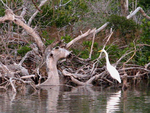
Pelican Bay's name is well deserved as there were lots of pelicans there plus many other birds such as the Great Egret above.
........
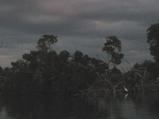
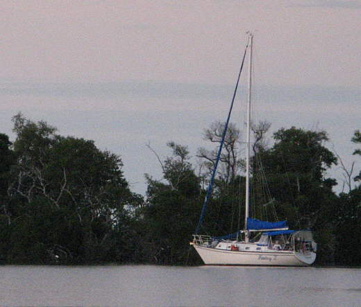
With the day coming to an end we enjoyed the new to us view with...
........
.... other sailboats nearby us.....
........
....resting on the peaceful waters here in the bay.
........
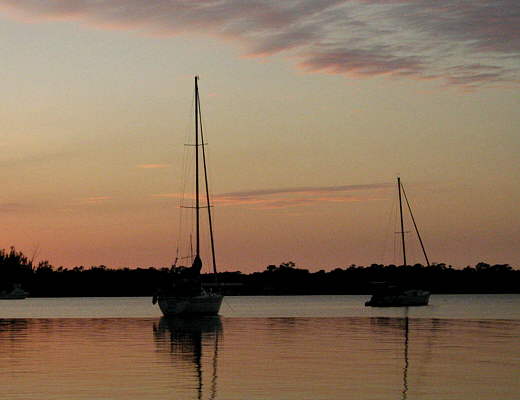
We felt good about the days journey for us. The first of its kind in our yet very limited experience as boaters. Ruth was back to normal and we ....
........
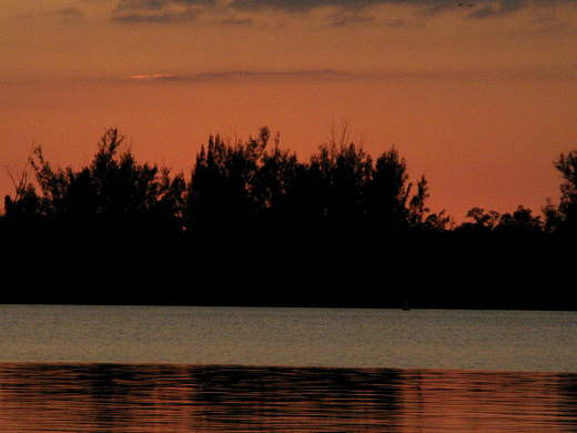
... took in the last rays from the sun for the day and fixed a dinner and went off to bed tired, but happy.
........
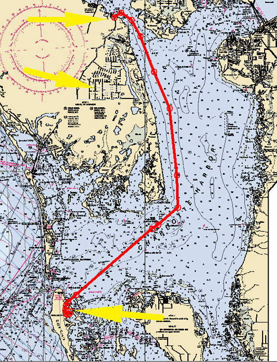
The chart above shows our 25 mile route (red line) from the lock (top arrow) to Pelican Bay (bottom arrow). The top middle arrow points to the fresh water canal system.