..--- Finally We Might Be Getting Somewhere ---
.........................................--- Friday Oct. 02, 2009 ---
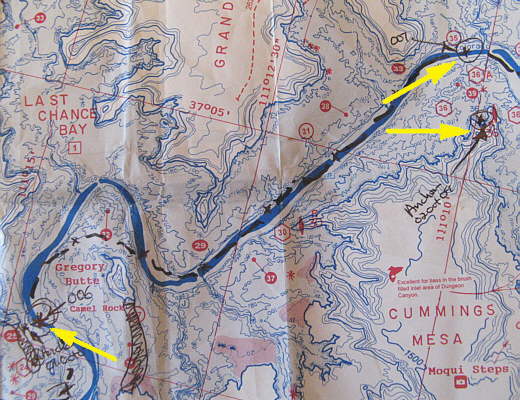
Day's Starting and Stopping Points Under Sail:
Today's Starting Waypoint #6 = N. 37o 02.741' -- W. -111o 14.300
Today's Ending Waypoint #7 = N. 37o 06.172' -- W. -111o 10.453
Night's Anchorage: By point on south side of channel north of Cummings Mesa.
Anchorage = N. 37o 05.782' -- W. -111o 10.059'
Today's Progress: Sailed Total = 9 1/4 miles -- Up-Lake = 7 miles -- Motored = 1/2 milesTrip Totals: Sailed 39 1/2 miles -- Up Lake Miles 25 -- River Mile 36 -- Motored 11 1/2 miles
After a sub 50 degree night made bearable by 3 blankets we awoke at 7 a.m. to a light southwest wind blowing us out on the anchor away from the spit of land that stuck out like a tongue from the nearby butte. We had decided to try and get sailing earlier to take advantage of the light morning winds that had been fairly common.
Since the boat was being blown away from the shore I wanted to see if I could sail off anchor by myself. With Ruth cleaning up after our breakfast, usually a joint job, I removed the straps that we use to secure the main to the boom at night and prepared the main so I just had to hoist it when ready. I also went forward and undid the jib from its strap and prepared its halyard for hoisting. With the sails ready to be raised and the wind still pushing the boat away from the shore I raised the anchor and secured it. Going by the mast I raised the jib and then the main quickly. by now Ruth was watching and ready to help if I needed it. In a not so smart move I hadn't lowered the outboard into the water and started it for the "just in case this doesn't work scenario".
Somehow the jib had caught some air by itself and moved the Kera Jane in towards shore and the shallow water there. Part of the problem was that the rudder had swung over since I hadn't secured it in the middle and it was in cahoots with the jib to run us aground.
........
In the seconds it took me to get the rudder turned and the sails set with their sheets we were in shallow water and I was sure the rudder would probably kick up, but somehow it didn't and the boat turned into deeper water. I can see that more practice is in store for sailing off anchor single handed.
........
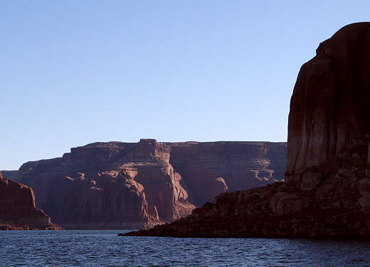
Out in the channel and on a broad reach we quickly reached the point (above) about a mile away that we had struggled trying to reach with no success the night before and had given up and anchored. After reaching the point we started running with the wind more behind us in an easterly direction. First though we had headed south thinking the main channel was in that direction. Where the channel is can be really deceiving on Lake Powell with .....
........
......the huge canyon walls blending in with each other and side canyons appearing as large or larger than the main channel. We were navigating using the Fish-N-MapCo Lake Powell South and Lake Powell North maps and I highly recommend getting these if you plan on sailing Lake Powell.
With the Mac going in a southerly direction and then looking over the map I could see we were headed towards a side canyon and we corrected that error and started......
........
...... running in the right direction. Another problem you can have is the maps show the lake at "full pool level" which it hasn't been at for years. With the lake down 80 feet or so the map shoreline and the one you are looking at can be quite different. Also the channel markers shown on the map weren't always in the same place as the real ones on the the lake due to the fact they move them around if needed to mark a safe channel at the current lake level. With binoculars you can usually spot the markers, but be careful as they are also used in some places to mark the route up side canyons.
........
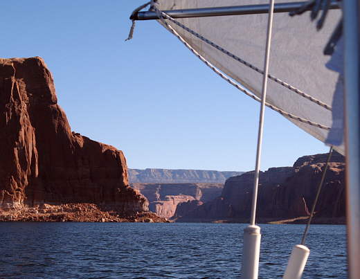
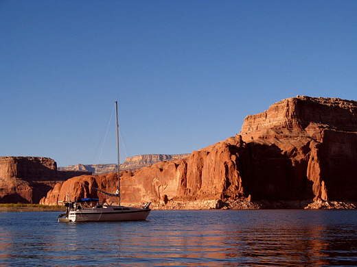
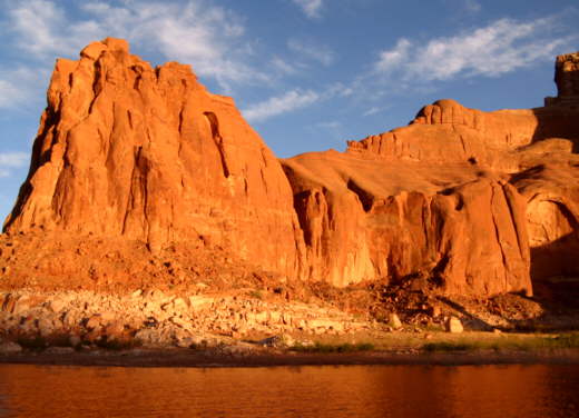
After passing this very high dollar houseboat pulling a twin hull speed boat that probably cost more than dozens of Mac 26's like ours we ran for about a mile and a half and rounded the point behind it in the picture above. Then we headed northeast................
........
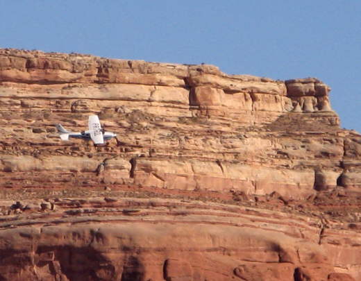
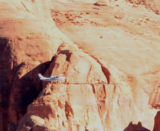
............ for about 4 miles. It wasn't long after starting on this new course that the wind died and slowly came back now from the northeast, a 180 degree change in direction. We started long slow tacks in the 3/4 mile wide channel in light air. As we were doing this a small plane came down the canyon and...
........
........ came back around to circle us once and then head on its way. As we neared the next bend in the lake with it still about a mile away the wind picked up and we were up over 2 knots and it felt like 20 after the other miles where our speed wasn't even registering on the depth finder. Well that burst of speed lasted only a few minutes and then was over and we entered what seemed to be a dead air zone. We could see air induced small waves rippling on the water 1/2 mile ahead and 1/2 mile astern but not where we floated in what seemed to be a vacuum. After floating in the same area for a couple hours and with it now past 5 p.m. we marked our position on the GPS and motored over..............
........
........ a half mile to the south shore to a small cove on the south side of the main channel inhabited by a mommy duck and her not so small babies swimming among some flooded brush and tamarisk trees there.
........
We tried to take the Zodiac ashore, but the shore bank there was soft mud and we didn't want to step off into it. From the dingy we were able to see some Great Blue Heron tracks and some fresh coyote tracks crossing over them.
........
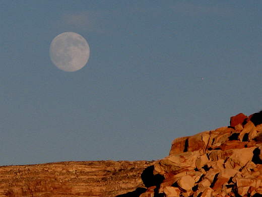
Back on board we watched a now full moon rise over one canyon wall and the sun go down 180 degrees to the west.
........
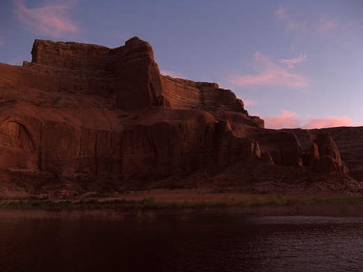
I call this the magic hour as the red rocks really come alive with an unbelievable change of color induced by the setting sun. This might not be the best lake to sail, but the scenery is unforgettable. It is like no place you can go in the northern hemisphere or maybe the whole world if you want to see towering red rock walls soaring above the clear blue water which can turn into liquid gold at sunrise and sunset. These views come together and then sweep away in all directions in a seemingly unending panorama.
........
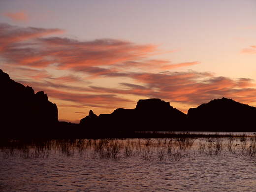
Then the sun sets and you are left with the final visual delights that you will always remember and .............
........
.......... even with the sun fully down there is still a soft warm glow emitted from the canyon walls above you.
All in all it has been a great day with 10 miles sailed and 7 miles of it up-lake. Our most to this point. Now if we can only make Dangling Rope Marina tomorrow, which is probably 6-8 miles away we will have ice again and be happy campers. It was off to bed completely oblivious to a challenge we would be faced with in the morning that we had heard about happening to others, but that had never happened to us.
........
The left arrow point to where we started sailing (waypoint #006) and the top right arrow is where we finally quit (waypoint #007). The bottom right arrow was the night's anchorage. If the lake would of been full we could of cut right across (just to the right of the bottom left arrow), but now that is dry land (were I hatched it in), so we had to fight to get up around the point just above the left arrow.