.......................................--- Sailing to Gregory Butte ---
.........................................--- Thursday Oct. 01, 2009 ---
Day's Starting and Stopping Points Under Sail:
Today's Starting Waypoint #4 = N. 37o 01.242' -- W. -111o 19.404'
Today's Ending Waypoint #6 = N. 37o 02.741' -- W. -111o 14.300 (note waypoint #5 was the last anchorage)
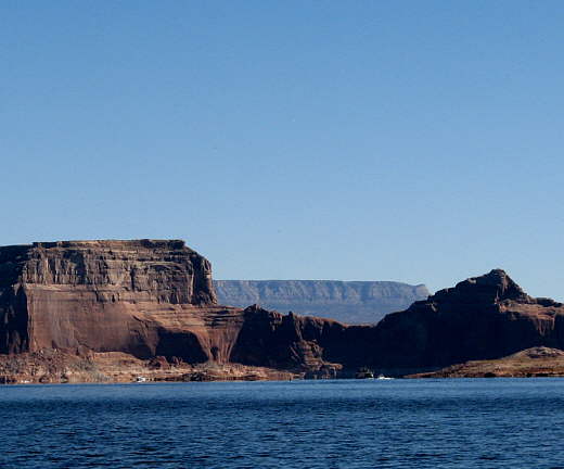
Night's Anchorage: West side of channel opposite Gregory Butte.
Anchorage = N. 37o 02.474' -- W. -111o 14.729'
Today's Progress: Sailed Total =10 1/2 miles -- Up-Lake = 6 miles -- Motored = 2 milesTrip Totals: Sailed 30 1/4 miles -- Up Lake Miles 18 -- River Mile 30 -- Motored 11 miles
The night's sleep was not go good due to the shore line and anchor line, which were both tied to the bow, fighting each other. Most of the night the wind was coming from the north and wasn't that bad, but we were unprotected in that direction from the waves which built and were driven in on us. The waves would lift the boat on one line so far and then the other line would tighten and then yank the boat sideways. We were in bed 10 hours and probably slept at least 8 of that, but still you would lay there waiting for the sideways jerk, knowing it was coming. Hopefully we won't be anchored like that in the future.
Each night we seem to be more wore out and are ready for bed sooner and sooner. At this point 9 p.m. is becoming bedtime and about 7 a.m. is time to rise. Since it is now the first of October the sun is setting around 7 p.m. and rising a little after 7 a.m. and of course the hours you actually see the sun vary due to any high canyon walls you might be near.
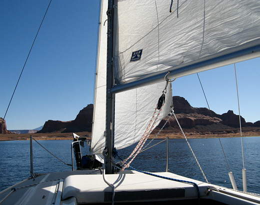
After all the drama of the previous day and a half getting off anchor and the shore line was melodramatic with only a very mild wind up and blowing. We then ran on the Honda back to the point we had stopped sailing two days previous a couple miles away. The forecast was for northwest 10-20 mph winds for the day and we were a little apprehensive about the 20 mph part. When we were back to the our starting waypoint and raising the sails the wind seemed to be picking up some so we decided to start with the main on the 2nd reef point where it still was from 2 days before.
Well after sailing that way for less than 5 minutes the wind died to nothing and that was where it stayed for most of the day with periods of no wind and longer periods of 2-3 mph winds and some much shorter periods of 5 mph wind. Most of the wind was from the northwest, but forget the 10-20 mph stuff. We would find that the wind speed predictions were more like guesses sometimes they got it and other times they were way off.
........
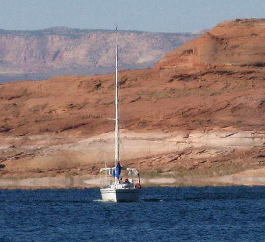
After making a mile or so up-lake a sailboat, the first we had seen anywhere on the lake, with a man and woman motored up along side of us. As they passed on our starboard side hellos were exchanged. They looked at us as if we were crazy after we mentioned we were trying to only use our sails in order to reach Bull Frog/Halls crossing still over 70 miles away or Hite still over 120 miles away.
We also were starting to question the feasibility of this as it seemed that if we were lucky enough to have any wind it was either under 5 mph or over 20 mph. At the end of this day we had sailed 30 some odd miles, but only made it up-lake around 18 and that was after 5 1/2 days on the lake. We were really having to be patient as we were doing a lot of floating/drifting around waiting for wind that we could work with. This obviously isn't for everyone, especially if they only have so much time to explore Lake Powell and all of the beauty there.
........
We talked about it more that night and decide to stick with the plan to only use the sails to move up-lake and just get as far as we could and then return to that location at a later date and continue.
........
We sat there and wondered if anyone has actually sailed the length of Lake Powell. As we made some progress up-lake under sail we also pondered one other problem we had and that was would our ice holdout until we got to Dangling Rope Marina still a ways up the lake or would we loose all of our cold food?
........
Also would they still be selling ice when we got there this late in the season?
........
Yesterday we had consolidated all our food and remaining ice into out best cooler out of the two we have on board.
........
Hopefully we could make Dangling Rope in the next 2 days and would still have a little ice left. One thing that was helping the ice situation was that the nights were now in the high 40's and the daytime temp was in the high 60's.
........
We had the pop-top down now at night and were using 2 blankets. Fall was here.
........
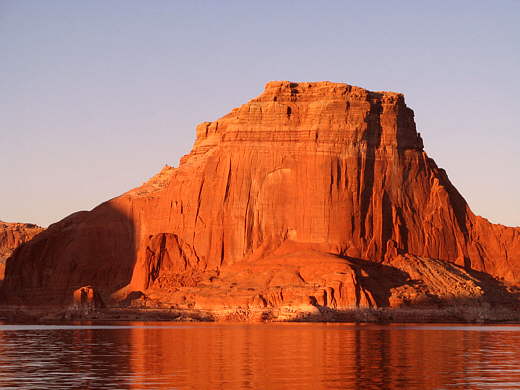
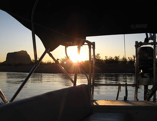
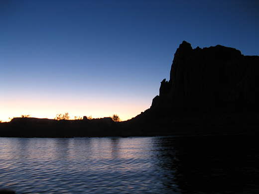
After finally sailing about 10 1/2 miles and making it up-lake about 6 miles we anchored on the second attempt opposite Gregory Butte (picture above) on the west side of the main channel. On the first attempt we put the anchor over and the rode out, but we weren't far enough off shore. I didn't want the rode any shorter and when I went ashore with a stern rope I could pull the Kera Jane stern first onto the shore before the rode was at its end. At this point in the trip we were still afraid to have either the stern or bow sitting on the shore at night, especially on the main channel, where the waves off of passing houseboats would make the boat ride up and down on the shore. We would reconsider this later in the trip.
........
For now though we played it safe and pulled the anchor up and moved 100 yards further north on the north/south running shore and re-dropped the anchor where we could let out enough rode and still stay off of shore.
........
The forecast for the next couple days was calling for light winds and/or 10-20 mph winds. Hopefully we would start making better time (mileage) up-lake.
........
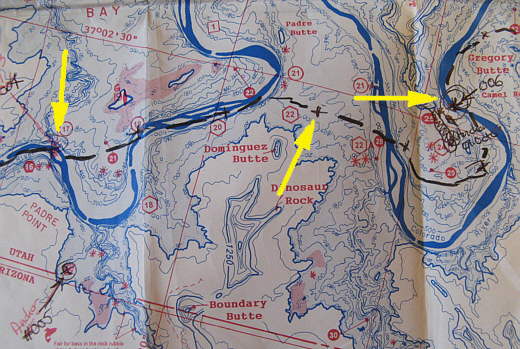
We left our anchorage (#005) bottom left of map and motored back up to waypoint #004 (top left arrow were we had quit sailing two day previous and from there sailed to waypoint #006 (right arrow). The middle arrow points to where we were able to cut across the lake and put in less actual miles than if we would of followed right above the original river channel. If the lake is full you can cut across more places than if it is down like it was on our trip. Below the right arrow I drew in the spit of land that was out of water where we anchored for the night.