..................................--- Back On The Lake Again ---
.....................................--- Thursday Oct. 08, 2009 ---
Day's Starting and Stopping Points Under Sail:
Today's Starting Waypoint #9 = N. 37o 06.360' -- W. -111o 03.036
Today's Ending Waypoint #10 = N. 37o 08.054' -- W. -110o 57.223
Night's Anchorage: Southeast side of bay by Oak Canyon.
Anchorage = N. 37o 06.863' -- W. -110o 57.235'
Today's Progress: Sailed Total =7 1/2 miles -- Up-Lake = 7 1/2 miles -- Motored = 2 1/2 milesTrip Totals: Sailed 59 miles -- Up Lake Miles 41 -- River Mile 51 1/2 -- Motored 17 1/2 miles
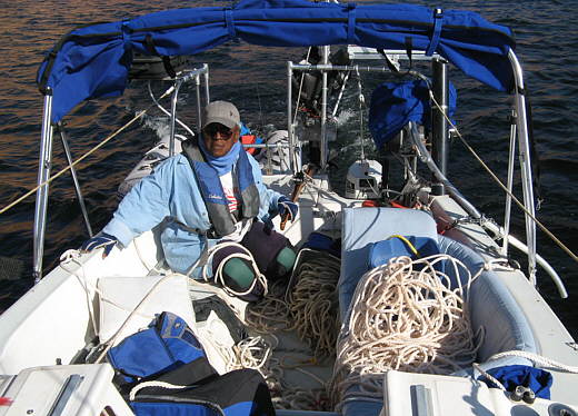
We finally got out of Balanced Rock Canyon after 5 nights there. I'm healing, but still only have limited use of my right arm and most of that is done with pain. Pain or no pain our anchorage at the side of the canyon was not good and we had to get out of here. A few times the wind came out of the northwest and the boat couldn't swing around with its stern to the southeast as the four shore lines, two to shore and two to the island, would get tight and come out of the water and act like a rope fence trapping the boat on the north side of them. The dingy was also getting trapped since the boat would swing into the ropes on both sides and no matter which side the dingy was on it would go under the lines and sometime get trapped on the other side and then hold the Mac there. We finally lashed the dingy to the ladder and to each side so it stuck straight out off the stern, but that didn't work all of the time either.
Anyway if I wouldn't of been injured we would have been long gone from this anchorage. Now the problem was how to get out of here since we didn't have an anchor down that we could pull to. I pulled myself to shore with the dingy and brought the Danforth and its rode back to the boat after retrieving it from the crack it was wedged into. I left the other shore line attached.
Next I went to the island and took the Bruce and its chain and carefully draped the chain back and forth over the bow of the dingy and put the Bruce on the front seat. Then I tried to paddle with one and one half arms out about 20 feet from shore and dropped the Bruce and its chain on what looked like a rock shelf about 8 feet down. Well the shelf was slanted and the Bruce slid off of it into very deep water of unknown depth. Ruth pulled the slack out of the rode by hand and then used the winch to pull it in tight. The anchor seemed to hold when I slacked off the other line that went to the rock island, but we were worried as there wasn't much water behind or to either side of the Mac before it would run aground.
Quickly Ruth pulled me back with the line to the rock island that I had just released. When I got to the bow of the boat I grabbed the shore line and pulled myself to shore and untied the one remaining shore line. We were only on the anchor now. Ruth again pulled me back to the Mac.
........
There was now 600-700 feet of line in the cockpit with Ruth, but stowing it would have to wait as the Kera Jane was in danger of running into one of the nearby rocks.
Back aboard I made my way to the bow and started trying to pull the boat towards the anchor. The rode was still attached to the winch and Ruth would take the slack out as I pulled it up one-handed. She was also on the outboard and tiller trying to maintain our position by going into forward and/or reverse depending where the wind was taking us. At this point the anchor wasn't holding us anymore as it was off the bottom and straight below us on the line and chain. Finally we were to the 25 foot mark on the rode and then to the 30 feet of chain. By now the boat had swung around 180 degrees and had her stern pointed out into the bay. Without any other choice Ruth started backing her that way. Finally the anchor was out of the water and on the deck and then into the anchor tube.
Now with a little room to maneuver in Ruth turned us around and headed back out to Lake Powell's main channel. I took the jib bag forward and attached the jib and the main was already ready to raise at any time.
When we reached the main channel the wind was probably 8-10 mph and they were predicting 15 mph winds by noon. We went to the far side of the channel where we had stopped sailing 5 days earlier and turned into the wind and floated there with the Honda now off and stuffed all the lines back into their rode bags.
With that done we raised the main only and it was till on its 1st reef point and we left it there. We started running up the lake with the wind at our backs averaging about 4+ mph on the GPS and 4 knots on the depth finder.
........
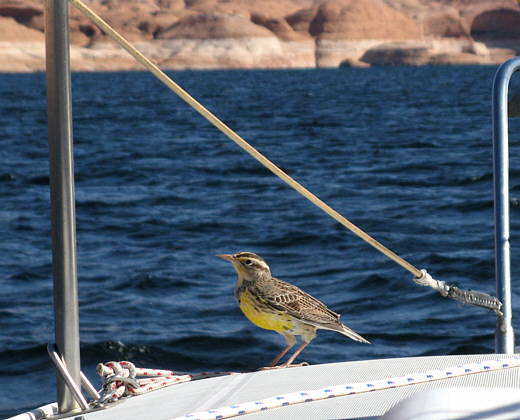
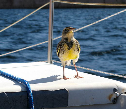
We picked up a passenger, a ................
........
........ Meadowlark that appeared to still be a baby and we took that as a good omen for whatever reason. He got scarred with these rookie sailors and flew off finally.
At that point we could of probably taken the reef out of the main, but since the wind seemed to be picking up and we were pretty sensitize to wind due to our experience a few day earlier 4 mph was plenty fast for us.
........
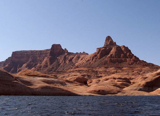
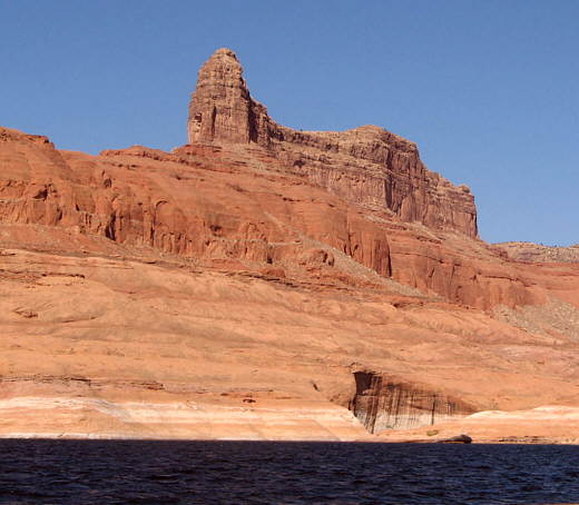
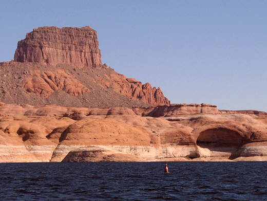
In just a little over an hour we made the 4 1/2 miles to the mouth of Forbidding Canyon where Rainbow Bridge is and ...........
........
where probably 80% of the traffic on the lake had been headed. On this trip side trips were out of the question so we sailed on by the canyon in the increasing wind.
A couple time we would have had a bad jibe, but the preventer did its job, yet I needed to do a better job and rig a second one (wait a couple days). About 3 miles further the wind had picked up to the point where it wasn't much fun even though I was seeing 5 knots at time on only the reefed main. For once we had a houseboat behind us and he couldn't catch us and that was pretty cool, but it was time for us to quit for the day.
........
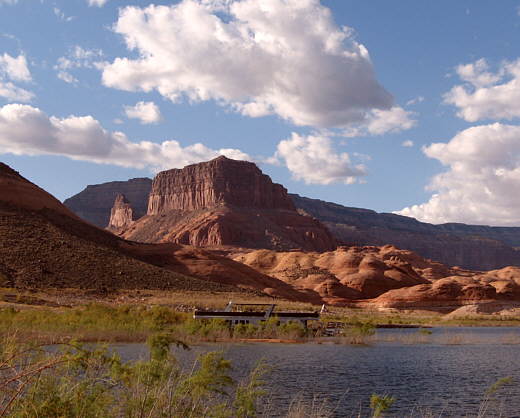
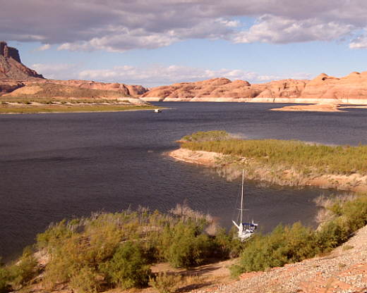
We were at a point where I had seen on the topo map what appeared to be a large fairly shallow bay with possible good anchorage's on its southwest side. We marked our position and dropped the main and motored about 1 1/5 miles south into the bay at Oak Canyon and over to its west side and started to search for an anchorage.
........There were 5 house boats spaced around the bay about 1/4 to 1/3 of a mile apart for the most part. They had been run up onto short sandy beaches with tamarisk trees growing everywhere else along the shore. Every time we were in shallow enough water to toss the anchor the nearby bottom was clogged with these small trees.
After our experience with the anchor rode being trapped in a tree and me now unable to repeat the underwater trip to untangle a rode wrapped around a tree we ruled almost every possible anchorage out.
........
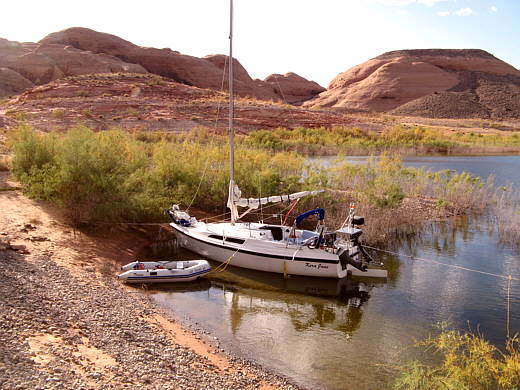
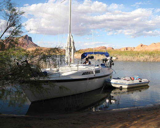
Finally we spotted a small "V" shaped inlet not much wider that the Mac at its end. It was over on the southwest side of a small bay. The very end of it was sand about 8 feet wide. Ruth ran us into the "V" and put the bow up on the small patch of sand. This was a first for us. We had run ashore before, but it was always after screwing up and not on purpose.
Next the bow was tied to a tamarisk tree about 10 feet straight ahead.
........
The back of the small bay swung past the Mac on the south and then turned north about 150 feet off the Mac's stern. I took our stern line and walked it around the bay until I was directly behind the Mac and tied it off there to another tree.
........
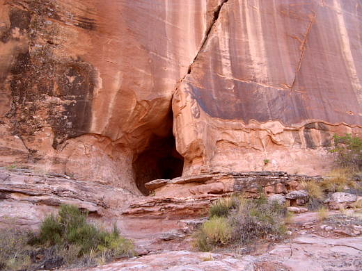
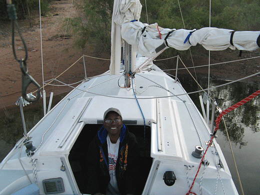
With the Mac safe and sound I took a short hike up the nearby hillside where I could look back on three houseboats that were also in the larger bay.
........
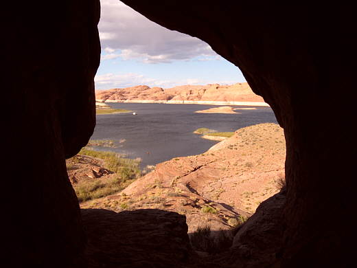
Up the hill a ways there was this intriguing small cave that had a.............
........
.......... great view of the lake out of its mouth. Then it was back down to.....
........
....... the kera Jane where...........
........
........ Ruth was waiting for me.
........
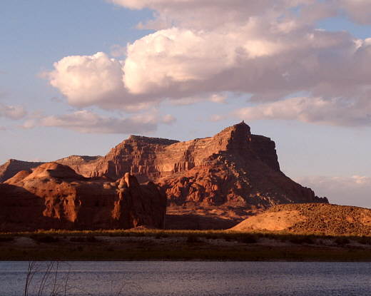
We had a nice supper and then watched the last light of the day as it.........
........
........played out its closing act on the nearby canyon walls.
After dark we took some time to look at the stars. We had gone through the full moon stage on the previous nights and now the moon wasn't up until about 9:30 p.m. or 10 p.m. so we had a really dark sky and were rewarded with more stars in the sky than anyone could imagine.
With the Milky Way stretching out overhead it was easy to find the Big Dipper and then up to the North Star at the end of the Little Dipper's handle. After star gazing for a while it was off to bed for a great night's sleep feeling like we were tied right into a slip, which at this point we have never experienced.
........
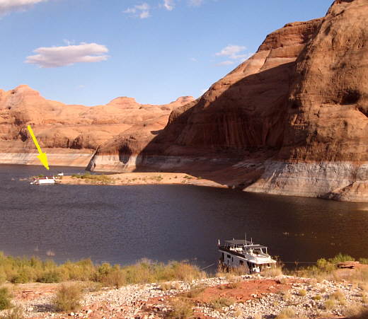
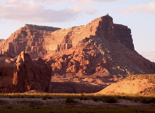
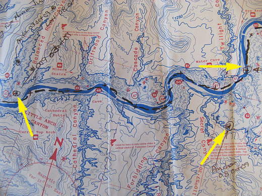
Finally we leave Balanced Rock Canyon (left arrow) and sail 7 1/2 miles up the lake to waypoint #10 (top left arrow). Then we motored down into the bay (bottom right arrow) where we tied to the shore.