................--- Fresh Water Canal to Part Island ---
.......................................... ..........--- March 12, 2011 ---
Nights Anchorage: 026o 39.562' N -- 082o 11.742' W -- Part Island
Trip Odometer: 28.1 miles
Days Mileage...: 22.1 miles
In the morning we were up early and over to the lock with no problems. At the lock a boat was going out right ahead of us. I put in at the dock just before the lock so that Ruth could get out and operated the lock controls ...
........
....on land. That is easier than trying to keep the boat right at the controls on each end of the lock and in the middle and operating them from in the boat. This guy that was with the boat ahead of us yelled at us and asked if we would like him to work the controls. We told him that would be great and Ruth gets back into the boat and he opens the lock up for us. As we start to enter he takes off and goes down to the boat that had just locked through and takes off. I was not a happy camper because now we had to operate the controls from the boat just what we didn't want to do. Well in retrospect we made it with out too much difficulty.
Then it was out the narrow and shallow channel into Charlotte Harbor which we also managed without going aground. Once out in the water it was back to tracing the first part of the route we had taken in the fall towards Pelican Bay down near the Gulf.
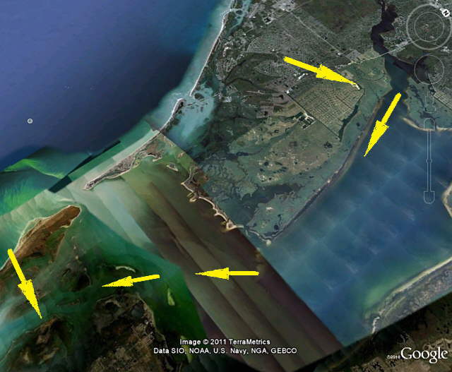
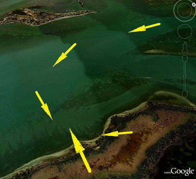
On that trip when we were headed north from Captiva to Pelican Bay going home I noticed a sailboat peel off of the ICW before Cabbage Key and head northeast towards the northwest tip of Pine Island. I checked that out on the charts and see that there is a very shallow area up by Pine Island, see chart below, but if you could get through that ok then it would cut off some miles vs. going to Pelican Bay and then south towards Captiva. Another problem is that the route didn't offer much in protected anchorage, but if the wind was light or from the right direction, east in our case, then it was a doable route for us.
Well we went that way, again see charts below, and had no problems and hooked in on the west side of Part Island and put the anchor down for the night.
........
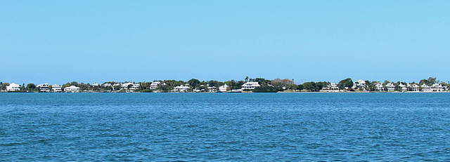
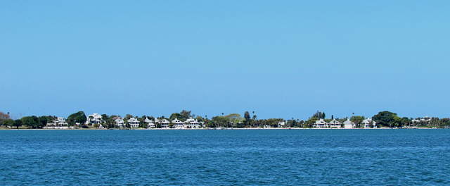
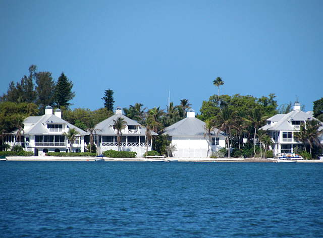
About 3/4's of a mile across the channel were a ...
........
..... number of houses on the east side of Useppa Island. I find it amazing that there is no ....
........
.... road to Useppa Island plus a number of other islands in the area. That means that all of the materials and labor to build these houses had to get there either by water or air. Note the above picture and all of the other pictures for this trip were taken with a new camera that was a Christmas present. It is a Cannon SX30is, with a 35 power optical zoom and a 4X digital zoom on top of that. It isn't a small digital camera, but I love it. Even the full zoom pictures, optical/digital combined, are nice shots as you can see above and in other pictures with this trip report.
........
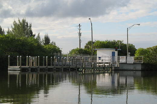
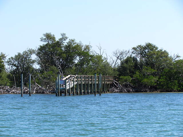
Part Island, which we were anchored near, did not have homes on it, but nearby our anchorage was this landing. Don't forget that with the telephoto on the camera we usually aren't near as close to objects as the pictures might indicate.
The weather was holding good and we had no problems on this anchorage.