............................Previous Page............................................ Next Page If There Is One
.................................--- Using Screen Dumps As Aids ---
Here We are trying to find info about 2 possible locations to anchor if needed between Little Shark River on Florida's SW coast and either Marathon or Long Key in the Keys. We hope to make the trip in a day, but if weather or a problem comes up it would be nice to have a couple backup anchorages that might give us a little protection.
The following images were collected using the "Print Screen" key on the keyboard while looking at either NOAA Charts using SeaClear II or Satellite images from Google. Then I paste the screen dumps into a graphics program and edit the area that I want to view. I've also done this for potential anchorages along our route in other areas. The satellite images give us a better feel and show beaches and other detail the the charts don't show. I label the images and put them in a folder to view later also on the boat's computer on the trip.
............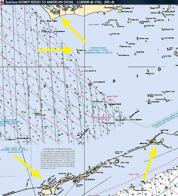
After heading south from Little Snake River our destination would be either Marathon (bottom left arrow) or Long Key (bottom right arrow). I'm interested if either the anchorage at Carl Ross/Sandy Key (middle arrow) or the channel to the east of Cape Sable (top arrow) would be suitable for our Mac 26 that draws less than 2 feet?
............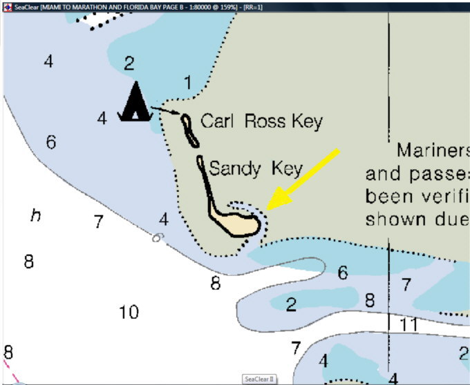
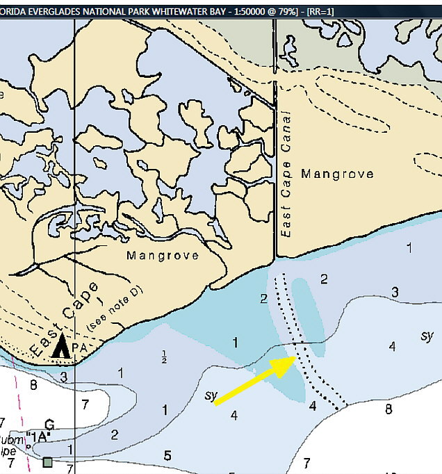
Here is a part of a NOAA chart showing what appears to be a channel up the eastern side of Sandy Key for a bit.
............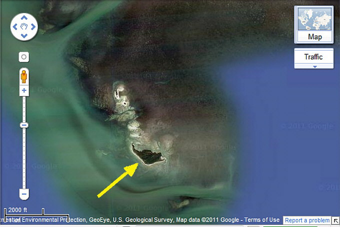
A satellite view of Sandy Key, arrow.
............
Here is another that seems to show the channel on the cart and the possible anchorage.
............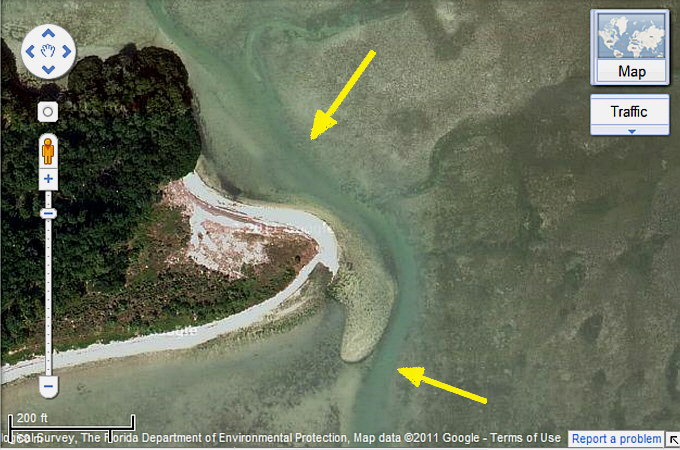
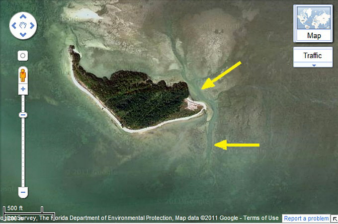
And a close-up view of the end of the island.
............
East of East Cape Sable the chart shows a channel going to a canal.
............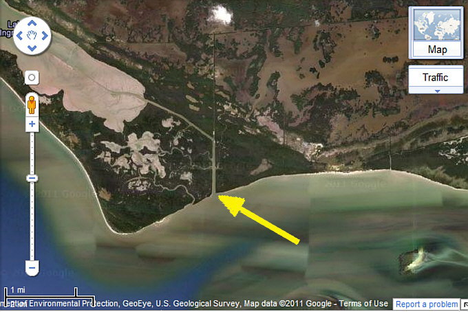
A satellite view of the same area.
............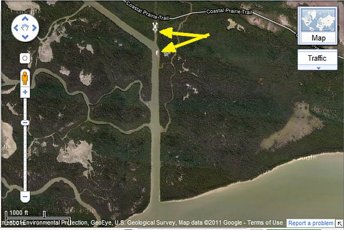
Up in the channel are a couple barges/work boats??
............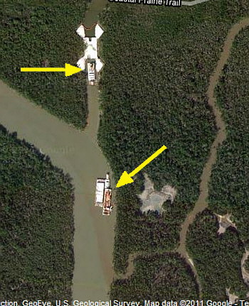
A close-up of the boats. I'm assuming that these must draw at least 2 feet, but don't know for sure. The channel is about 200 feet wide and there are a couple feeder streams coming into it about .4 of a mile from the gulf where it looks like one could anchor on a Bahamian Moor and stay out of the way. This anchorage is only being looked at if we were in this area and bad weather/wind was coming in before we could move somewhere else.
It isn't that hard to capture these images on your computer at home or on the water if you can connect to the Internet and save them for viewing later.