.......--- Back to Pelican Bay and On To the Lock --
............................--- Fri./Sat. - Dec. 10th and 11th ---
Day's Starting and Stopping Points:
Friday's Starting Waypoint = 026°30.491 N -- 082°11.158 W
Friday's Ending Waypoint = 026°40.999 N -- 082°14.128 W
Fri. Anchorage: Pelican Bay
Anchorage = 026°40.999 N -- 082°14.128 W
----------------------------------------------------------------
Saturday's Starting Waypoint = 026°40.999 N -- 082°14.128 W
Saturday's Ending Waypoint = 026°56.409 N -- 082°11.715 W
Sat. Anchorage: Inside Freshwater Lock
Anchorage = 026°30.491 N -- 082°11.158 W
We left Jensen's on Friday and made our way back to Pelican Bay. We only planned on staying at Jensen's for the two worst nights of the storm, but it remained cold and rainy until Friday morning. We thought we had weathered the coldest weather there, but we soon found out that wasn't the case.
It was only going to be nice for about 2 days and then even colder weather with 40+ mile an hour winds were suppose to move it. We figured the best place for us was back inside the narrow freshwater channel where we had started the trip, so
....we motored back to Pelican Bay on Friday and spent the night there.
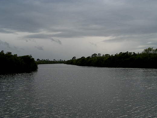
We wanted to go on to the lock on Saturday, but woke up to heavy, heavy fog. We couldn't see anything but the dense fog. It was a long ways to the lock where we wanted to be that evening, over 20 miles and the days had grown shorter with sundown just past 5 p.m. We figured we needed to leave by at least noon to give us a little wiggle room. About 11 the fog broke enough that I could see the park dock on Cayo Costa. I got excited and started to pull the anchor but it quickly closed back in around us.
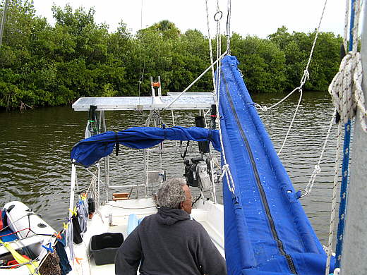
About 45 minutes later it lifted again so we could see about 1/2 mile. Ruth was on the phone with her daughter and I said "let's go". She hung up and I started the motor and went forward and started pulling us to the anchor as Ruth slid into here PFD. She then motored us out of the bay as soon as the anchor was up.
A large powerboat passed us right at the narrow outlet to the bay even though it was a 'no wake' zone and a catamaran also prepared to leave behind us. Others had been waiting also.
Outside Pelican Bay the fog lifted even faster and we were on our way to just inside the lock. The wind started to pick up and started bringing waves in on the port beam. We let out with the Genoa on the furler and that helped to steady the boat and we could also cut way back on the outboard. The cat had caught us and was about a 1/4 mile off our beam to starboard. With the Genoa up we started to pull back ahead of them. Further up the bay we started to turn more to the west into the wind and furled the Genoa in and the cat stayed on its course towards Punta Gorda.
We could of gone on to All American Covered Boat Storage and taken out, but I told Ruth that I really wanted to sail some on this trip and felt if we could weather the next storm we might be able to sail for 2 days before having to take out and head north with the Suburban to Ruth's daughter's house for Christmas.
She agreed and....
... we stayed in the lock for the next couple days.
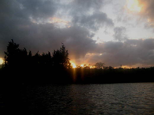
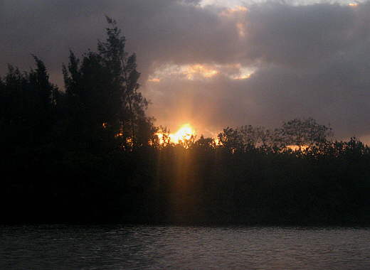
The day closed with some.......
ominous clouds, but they
proved to not be the next system, yet, as Sunday came with clear sides.
====================================================
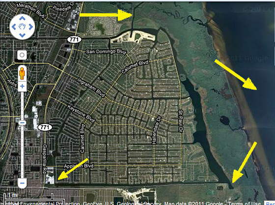
Above is an earth view of the fresh water system the surrounds and services the large development (lots of empty lots). The bottom left arrow points to All American Boat Storage and the bottom right points to where we anchored at the beginning and end of the trip next to a very high tower there.
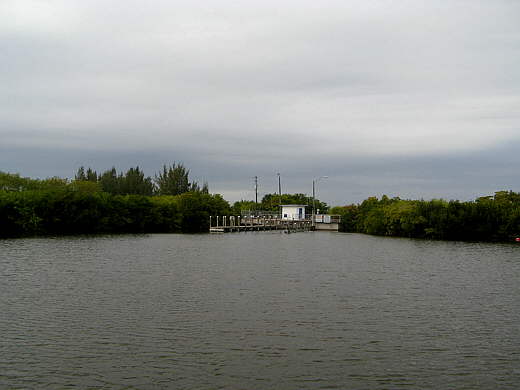
The top left arrow points to the exit to the lock where you exit into Port Charlotte+ Harbor (top right arrow).
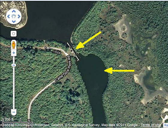
The bottom arrow points to the exit out to the lock, top arrow.
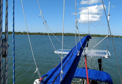
The top arrow points to the self-activated lock and the right arrow points to where we anchored. You can see from the scale (bottom left) that the anchoring location is just a little over 200 feet wide. This presents a problem if you anchor on one anchor and have enough rode out for the predicted 40+ mph winds. You will swing into the shore or into the channel to and from the lock entrance.
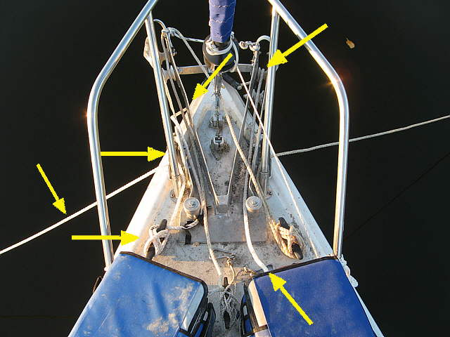
We put down two anchors on a Bahamian Moor with the boat between them. This results in the boat maintaining a fairly constant location. A problem arises thought when/if the boat swings around 180 degrees or more while anchored. This will happen during wind shifts like what happens when a front passes.
The lines then get wrapped around each other and the front of the boat.
If the lines just come off the front of the bow rollers you can have a mess when the swing happens. I reinstalled the bow chocks onto the sides of the anchor rollers and was glad that I did. Try and follow the lines above if you care to do so.
You will see that the lines from the rode back after the swing now are pulled up on the port side and go through the chock on that side and are cleated off. Likewise the line from the starboard rode bag is now pulled up on the starboard side of the boat and cleated over there.
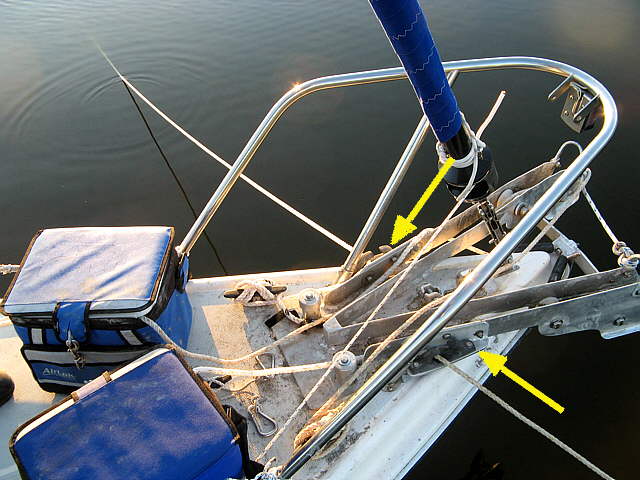
Above you can see the new chock location better. On the next trip when we went back to Florida I found a better way of doing this. I would set both anchors and then pull one of the anchors rodes up through the bow roller where the other line was and back through the bow roller and then cleat it off.
With both lines exiting the same bow roller the twisting problem seems of of gone away as of the date I'm writing this on the spring trip.